Article not found
This article is no longer available. But don't worry—we've gathered other articles that discuss the same topic.
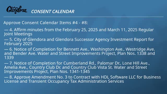
Glendora council approves ALPR expansion, slurry seal, design contracts and economic programs in series of unanimous votes
Glendora council renews outreach approach, motel‑voucher use and recommends contractor renewal for homeless services