Article not found
This article is no longer available. But don't worry—we've gathered other articles that discuss the same topic.

County communications chief: FOIA volume, news releases and joint information roles have expanded
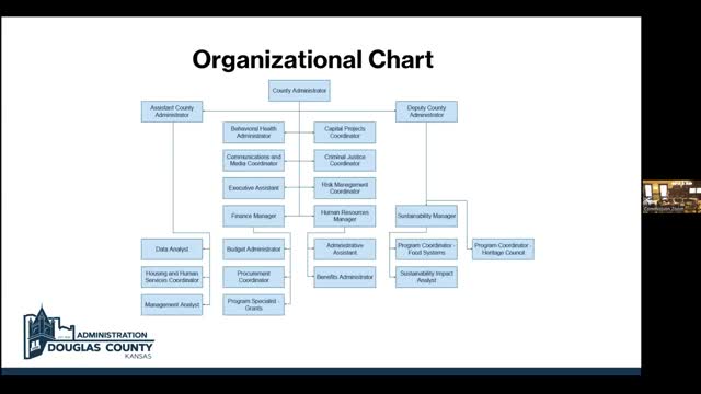
County administrator reviews organizational changes, ARPA distribution and staffing challenges

Douglas County GIS manager highlights GeoPortal, address database and emergency mapping role

Douglas County IT outlines cybersecurity posture, Power BI data projects and growing help‑desk demand