Article not found
This article is no longer available. But don't worry—we've gathered other articles that discuss the same topic.
Council approves partnership with Minot State University to recruit criminal-justice students as part‑time CSOs
Minot holds public hearing on Chapter 5 alcohol ordinance; council delays action to allow full review

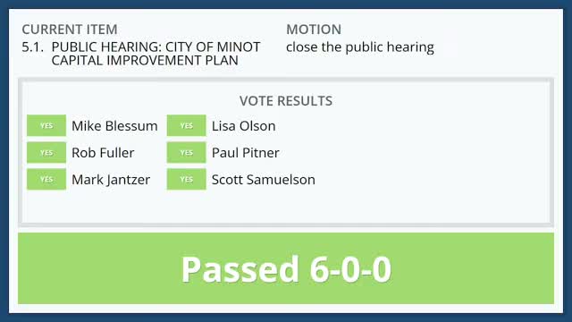
Minot council reviews $955.2 million capital plan; flood-control work drives majority of projects