Article not found
This article is no longer available. But don't worry—we've gathered other articles that discuss the same topic.
Horizon West says SunCrest SVC site is hardened, monitored and isolated from retail customers
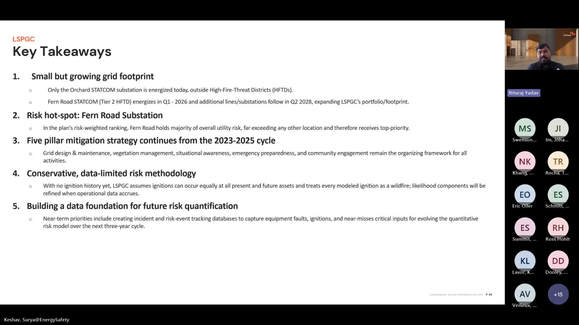
LS Power Grid California describes conservative, data‑limited wildfire approach for newly energized substations

Pacificorp pilots drones, infrared and satellite data; outlines enhanced safety settings and incident tracking