Commission supports trail‑map disclaimer, asks staff to produce interactive map for trail details
Get AI-powered insights, summaries, and transcripts
Subscribe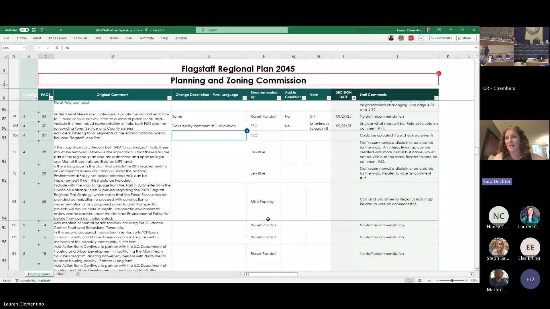
Summary
The commission agreed with staff recommendations to add a disclaimer to the regional trails map and to explore an interactive map to show details such as easements and authorized versus unauthorized trails; the U.S. Forest Service letter confirming conformity of mapped trails was discussed.
Commissioners agreed to a staff recommendation to add a disclaimer to the regional trails map and to explore creating an interactive map with more detailed trail information rather than showing unauthorized trails at map scale.
Transportation staff and planning staff presented mockups and explained constraints. Stephanie Santana, transportation engineer, said larger connectivity questions for the John Wesley Powell area would be handled through transportation analysis when development proposals come forward; Martin Entz added that some comments referred to foot trails, greenways and riparian connections rather than vehicular roads.
Staff recommended leaving easement data in place but showing a buffer or adding a map legend and a disclaimer that trail alignments and ownership should be confirmed prior to use or improvements. The commission accepted staff’s approach by a thumbs‑up consensus and asked staff to work on an interactive map that could include access points and additional detail at a finer scale.
Why it matters: Trail mapping affects how the plan communicates existing and planned regional trail routes, identifies access points, and signals whether a route is authorized. An inaccurate public map can encourage use of unauthorized trails or create confusion about ownership and maintenance responsibilities.
Outcome: Commissioners directed staff to prepare a map disclaimer and to pursue an interactive version that can show more detail; staff noted some mapped trails are designated through ordinance or federal designation and that authorizing construction or improvements may still require federal environmental review.
Source: Discussion and staff presentations, Sept. 29, 2025 Flagstaff Planning and Zoning Commission meeting.