Sumner staff review applicant-initiated map redesignation and rezoning proposals for southeast urban growth area
Get AI-powered insights, summaries, and transcripts
Subscribe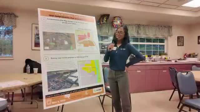
Summary
Krishanda Walker, an associate planner in the City of Sumner’s community development department, presented two applicant-initiated applications related to the city’s comprehensive plan map and zoning.
Krishanda Walker, an associate planner in the City of Sumner’s community development department, presented two applicant-initiated applications related to the city’s comprehensive plan map and zoning.
Walker said the first application concerns the city’s southeast urban growth area — parcels that are currently outside city limits but that would be annexed and should have a comprehensive plan designation aligned with intended future zoning. She said the map currently designates the area low-density residential and the application proposes changing part of it to medium-density residential while retaining interchange commercial adjacent to Sunset Ford and WinCo.
The second application Walker described is a rezone request for a parcel now surrounded by light industrial zoning off of 140th Avenue East. Walker said staff would support the rezone only if future access to the site (Parcel A) is taken from 30th Street East, and that future development could be warehouse-type uses at the time a project is proposed. Walker said the city “would have another opportunity to take a look at those impacts and mitigate what might be necessary.”
Next steps: Walker said both map-change applications will go to the planning commission for a recommendation and will later receive a city council public hearing.
Why it matters: map and zoning changes determine allowable housing densities and commercial activity when land annexes into the city. Access points and future industrial or warehouse uses can affect traffic, noise and infrastructure needs.
Status: these are applicant-initiated proposals that staff summarized; Walker presented staff conditions (preferred access point) and outlined the procedural path (planning commission recommendation, then city council public hearing).