Wilsonville officials debate access, infrastructure and land-use approaches for West Railroad area
Get AI-powered insights, summaries, and transcripts
Subscribe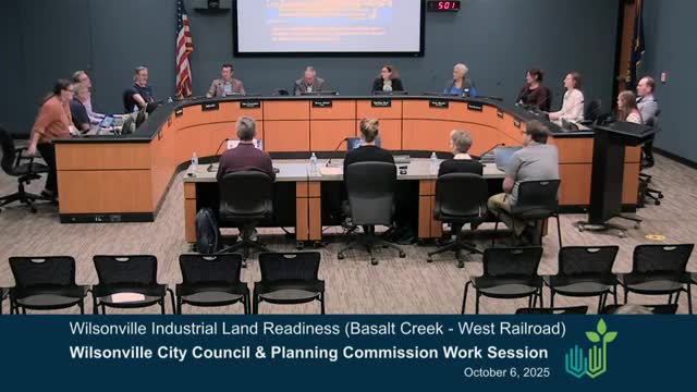
Summary
City staff and consultants presented three planning concepts for the West Railroad subarea of Basalt Creek and advised the council and planning commission that access constraints — particularly the Grams Ferry railroad undercrossing — and infrastructure costs will shape what kinds of employment and recreation uses can be feasible there.
Wilsonville officials and consultants convened a joint work session Oct. 6 to examine land-use and public-realm concepts for the West Railroad area, a partly undeveloped industrial subarea within the Basalt Creek planning area that lies mostly inside the urban growth boundary but outside city limits.
The most immediate constraint identified at the session was access. City staff and consultants told the council and planning commission that the Grams Ferry railroad undercrossing at the south edge of West Railroad is currently too low for freight trucks and that a 2025 planning-level estimate to upgrade and widen the undercrossing ranged between $33 million and $37.5 million. That limitation, along with fragmented ownership, wetlands, a Bonneville Power Administration easement and an active rail line along the eastern boundary, will affect where future streets, buildings and trails can be placed.
Consultants from MIG presented three illustrative concepts: a ‘Tonkin environment’ that emphasizes trails and natural amenities plus light employment; a manufacturing-and-industry concept oriented to higher-intensity industrial uses with multiple access points and more infrastructure investment; and a market-driven, low-investment option that allows existing, lower-intensity uses to persist. City staff said a preferred alternative will be drafted after the session and returned to the planning commission and council in November, with the goal of incorporating the final concept into the Basalt Creek master plan scheduled for early 2026.
Why it matters: West Railroad is identified in the Basalt Creek framework as employment land. How the city balances natural resources and recreational trails with the type of employment it seeks will determine what infrastructure is required, who pays for it, and how the area is annexed and zoned. The work session aimed to narrow trade-offs so staff can prepare a regulating plan and supporting code changes.
What the discussion covered
- Access and freight: City staff and engineering consultants said upgrading Grams Ferry to allow large freight trucks is a high-cost, high-impact move; other potential access options discussed included a northern connection to Tonkin Road and western approaches along Morgan Road, both of which involve significant technical and property hurdles. City engineer Zach Weigel noted that new public railroad crossings are difficult to approve and that BPA and PGE transmission lines near the tracks complicate any over‑the‑rail solution.
- Natural resources and trails: Consultants summarized recent habitat and wetland mapping (including Metro natural-resource data and a 2024 field survey) showing riparian areas and tree groves, and noted planned regional trails (Basalt Creek Trail and the Ice Age Tonkin Trail). Several councillors flagged the opportunity to integrate trails and natural amenities into any employment concept to create a distinctive place.
- Land use and marketability: Economic development staff and councilors stressed the city’s objective to attract jobs and assessed-value growth while acknowledging that some “sensitive” high-tech uses (for example, semiconductor manufacturing) are unlikely next to an active railroad because of vibration. Participants discussed craft-industrial, flex-space and mixed campus models that combine medium-sized employment facilities with amenity-oriented frontage.
- Ownership and current uses: Staff reported contractor yards, mining/gravel operations and some rural residential parcels in the area. A landowner group was described as holding a relatively large contiguous parcel that could make site aggregation easier than in other parts of the city’s employment map.
Actions and next steps
- No formal land-use action was taken at the session. Staff were directed to combine the feedback into a recommended alternative and return to the planning commission and city council in November for additional work sessions, then proceed with code work to implement the preferred concept as part of the Basalt Creek master plan update slated for early 2026.
Speakers (attribution whitelist)
- Alex Dupi — Principal, MIG (business consultant). First referenced Oct. 6, 2025, ~00:11:51 into the meeting. - Daniel Polley — Planning Manager, City of Wilsonville (government). First referenced Oct. 6, 2025, ~00:08:35 into the meeting. - Lauren (presenter) — Planner/Project ecologist (business/consultant). First referenced Oct. 6, 2025, ~00:13:04 into the meeting. - Miranda Batchel — Planning Director, City of Wilsonville (government). First referenced Oct. 6, 2025, ~00:08:51 into the meeting. - Cindy Luxoy — Associate Planner, City of Wilsonville (government). First referenced Oct. 6, 2025, ~00:09:03 into the meeting. - Matt Lorenzen — Economic Development Manager, City of Wilsonville (government). First referenced Oct. 6, 2025, ~00:09:03 into the meeting. - Zach Weigel — City Engineer, City of Wilsonville (government). First referenced Oct. 6, 2025, ~01:03:?? in the meeting. - Sean O'Neil — Mayor, City of Wilsonville (government). First referenced Oct. 6, 2025, at convening. - Carolyn Berry — City Council President, City of Wilsonville (government). First referenced Oct. 6, 2025, at convening. - Adam Cunningham, Councilor — City of Wilsonville (government). First referenced Oct. 6, 2025, at convening. - (Other named commissioners and councilors appear in the transcript; quotes in this article are limited to the speaker whitelist.)
Authorities cited in session
- Basalt Creek concept plan (adopted 2018) — referenced as the overarching framework for the area. - Salt Creek concept plan materials and Echo Northwest study (2024) — referenced as background analysis for West Railroad. - Grams Ferry railroad undercrossing evaluation (2025) — planning-level cost estimate cited at the meeting (staff: between $33 million and $37.5 million). - Metro natural-resource mapping — used to compare habitat mapping. - DKS corridor/transportation technical work — referenced for road network options.
Clarifying details and figures (from meeting)
- Estimated cost to upgrade and widen the Grams Ferry undercrossing: between $33 million and $37.5 million (planning-level estimate; meeting noted it excluded detailed studies, permitting and land acquisition). - Slopes greater than 10% cover roughly 20% of the West Railroad area, per staff presentation. - The closest municipal water and sewer tie-ins are at the Coffee Creek Correctional Facility, per staff. - The area includes contractor establishments, a north-end mining operation (gravel), scattered rural residential parcels and some vacant lots. - Approximately 90 acres of the area were described during the meeting as “unconstrained” for development in planning-level mapping (staff presentation).
Community relevance
- Geographies: West Railroad subarea (within Wilsonville UGB), Basalt Creek planning area, Coffee Creek Wetlands, Grams Ferry corridor. - Impact groups: industrial employers, contractor yards, nearby residents, trail users, regional trail network partners. - Funding/partners: development will require annexation, zoning, and likely multi-agency coordination (TriMet, Washington County, Clackamas County, BPA, state partners).
Searchable tags:["west-railroad","basalt-creek","industrial-development","Grams-Ferry","trails","natural-resources","annexation","infrastructure-costs","rail-crossing"]
Provenance:{"transcript_segments":[{"block_id":"block-415.915","local_start":0,"local_end":111,"evidence_excerpt":"Thank you. The focus of tonight's discussion is the future of an important industrial area just northwest of town, the West Railroad area. We'll be looking at public realm and land use concepts that will help shape the development of alternatives for further consideration by both the planning commission and the city council to consider.","reason_code":"topicintro"},{"block_id":"block-5972.71","local_start":0,"local_end":221,"evidence_excerpt":"So with that, I just wanna say that I really appreciate the contributions and participation of the planning commission tonight. The work is essential as we prepare for the successful development of this future area of the city. Your input tonight helps ensure that the vision for West Railroad reflects our shared values and priorities. And as a next step, the project team will develop a preferred alternative based on tonight's decision. That alternative will be brought back for further review and dialogue at the upcoming planning commission city council work sessions in November.","reason_code":"topicfinish"}]}