Get Full Government Meeting Transcripts, Videos, & Alerts Forever!
Get email alerts on the Transportation Lincoln Avenue topic
No spam. Unsubscribe anytime.
Urbana study recommends continuous bike lanes, road diet and consolidated crossings for Lincoln Avenue
Summary
Consultants and city engineering presented a corridor plan for 1.2 miles of Lincoln Avenue that proposes a three‑lane road diet, continuous on‑street bike lanes, midblock consolidated crosswalks with rapid rectangular flashing beacons and access management; staff will open a 30‑day comment period and return the draft for endorsement and grant use.
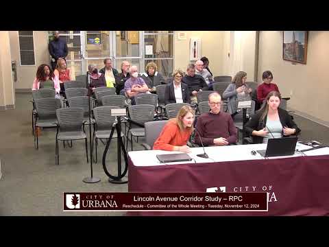
Urbana City staff and Regional Planning Commission consultants presented a Lincoln Avenue corridor study Wednesday that lays out a conceptual design for 1.2 miles of Lincoln Avenue from Green Street to Florida Avenue and proposes on‑street bike lanes, a three‑lane “road diet” and consolidated pedestrian crossings.
The proposal, presented by Carmen Franks, assistant city engineer, and consultants JD (RPC) and Kate (Lochmuller Group), responds to safety and pavement‑condition concerns and to public outreach that prioritized bike and pedestrian improvements. “Lincoln Avenue is a minor arterial,” JD said, noting the corridor carries between about 10,000 and 13,000 vehicles per day and that several segments see near‑failing traffic conditions during rush hours.
The study documents 337 crashes on the corridor between 2013 and 2022, including two fatal crashes, six severe injuries and 29 minor injuries; the crash totals include four cyclists and five pedestrians. Kate of Lochmuller described the study’s final proposal: “The final proposal…includes on street bike lanes for the full length of the corridor. This can be associated with up to 32% reduction of all crash types.” The plan also calls for converting much of the corridor to a three‑lane section (one travel lane each direction and a center left‑turn lane), which the consultants said could be associated with up to a 47% crash reduction on the affected segments.
To improve crossings and reduce vehicle‑pedestrian conflict, the study favors consolidating several non‑signalized crosswalks into fewer, better‑spaced midblock crossings equipped with rectangular rapid flashing beacons. The consultants estimated that RRFBs are associated with up to an 18% reduction in vehicle‑pedestrian crashes, and that access management to enable ideal spacing of consolidated crosswalks could be associated with up to a 44% reduction in all crash types.
The consultants said roundabouts were considered but rejected for key intersections (Illinois and Pennsylvania) because of close signal spacing (about 450 feet between Green Street and Illinois) and modelled queuing that would extend northbound more than 1,000 feet, producing gridlock. Instead the study favors coordinated traffic signals, signal‑timing optimization, leading pedestrian intervals and targeted turn lanes. The report also recommends relocating several MTD bus stops to far‑side positions and exploring protected—or vertically separated—bike lanes where right‑of‑way allows.
Public outreach informed the proposals: the team ran three outreach phases since April 2023, collecting several hundred survey responses and map comments; the second round in 2024 showed strong public preference for continuous bike lanes for the full corridor. The study was funded by a two‑year IDOT grant; consultants and staff said projects must be in the long‑range transportation plan to be eligible for federal or state funds.
Cost and next steps: consultants provided a high‑level conceptual cost of about $8 million for the proposed corridor work, subject to change if full pavement reconstruction is required. Staff said the project will enter preliminary design if funding is obtained; a 30‑day public comment period will follow the current draft and staff will return with a request for formal endorsement in the new year to support grant applications.
Questions from councilors focused on pedestrian refuges, lighting, access impacts for nearby blocks and construction staging. Franks said preliminary design will refine such details, including whether pedestrian refuges or supplemental lighting are feasible at each proposed crossing. On access changes, consultants said traffic modeling suggested no more than about 18 additional vehicles per hour would be diverted at any single intersection if some side‑street vehicle access were restricted, and that nearby Busey Avenue (ADT under ~275 vehicles per day) has capacity to absorb minimal reroutes.
No formal action was taken; staff will accept public comments during the announced 30‑day period and return to the council for final endorsement and to support funding applications.