Dawson County denies rezoning for 211‑home subdivision at Highway 9 and Dawson Forest Road
Get AI-powered insights, summaries, and transcripts
Subscribe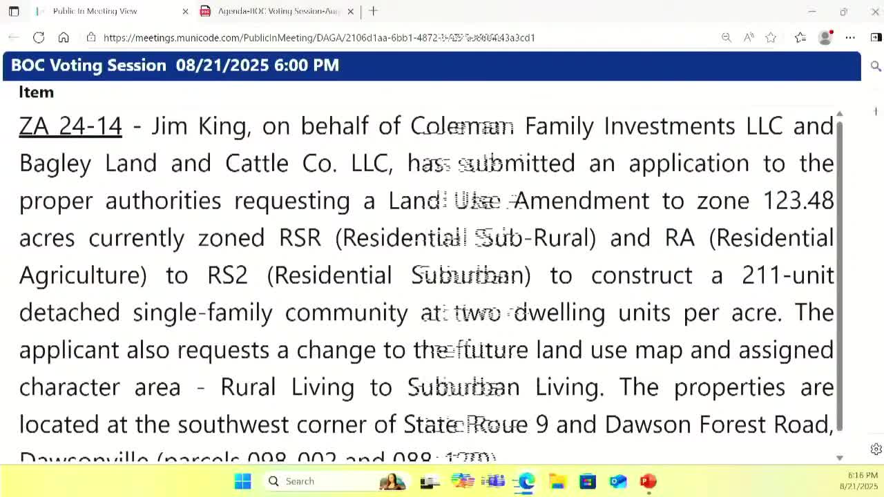
Summary
The Dawson County Board of Commissioners voted 4-0 to deny a request to rezone 123.48 acres for a 211‑lot single‑family subdivision after lengthy public comment and staff debate about the county's future land‑use plan and infrastructure capacity.
The Dawson County Board of Commissioners on Aug. 21 denied a rezoning request for 123.48 acres at the southwest corner of State Route 9 and Dawson Forest Road that would have allowed a 211‑lot, detached single‑family subdivision.
The board voted to deny application ZA24‑14 by a 4‑0 tally. The applicant, represented by Jim King, had asked to rezone two parcels from RA (residential agriculture) and RSR (residential sub‑rural) to RS‑2 (residential suburban) and to amend the county future land‑use map to suburban living to permit lots averaging less than a quarter acre.
The planning department and planning commission differed on the proposal: planning staff described the request and the character‑area changes required, while the planning commission unanimously recommended denial, citing inconsistency with the county’s future land‑use map and infrastructure concerns.
Applicant Jim King, who identified himself as representing Coleman Family Investments LLC and Bagley Land and Cattle Company LLC, told the board the two parcels have a gross density of about 1.7 units per acre and a net density of 1.9 units per acre and said the larger tract has been designated for suburban residential uses in prior comprehensive‑plan maps. “The majority of the property [is] designated as suburban living on the future land use plan,” King said, and argued the proposed house sizes, lot widths and the amount of preserved green space were consistent with suburban living examples in the county’s plan.
More than a half dozen residents spoke in opposition at the public hearing, raising traffic, school capacity and sewage and emergency‑access concerns. Tiffany Georgia, who described traffic and safety issues at the Highway 9–Dawson Forest roundabouts and at nearby Riverview Elementary, said, “Dawson Forest Road cannot handle a community entrance and exit that close to Riverview’s only entrance and exit.” She also said she had “personally witnessed emergency vehicles en route to an emergency have to drive up over the curb to be able to get through the intersection.”
Other residents from nearby neighborhoods — including Abbott Creek and Etowah Preserve — said current and recently permitted developments have already strained road and sewer infrastructure, and they questioned whether impact fees and county services would cover needed upgrades. One public commenter referenced a history of the area’s future‑land‑use designations and urged the board to preserve larger lots on the parcels that back up to established homes.
Commissioners framed the decision around competing concerns: private property rights versus the county’s capacity to serve new development. In remarks before the vote a commissioner said rezonings are among the board’s most difficult decisions and emphasized a current moratorium and the board’s desire to “review and recalibrate” growth and infrastructure before approving higher‑density rezonings.
Motion and vote: the motion to deny ZA24‑14 was made and seconded; the board returned a 4‑0 vote to deny. The planning commission’s recommendation to deny and the multiple public comments citing traffic, school and sewer concerns were noted in the record.
Background: The application covered two parcels previously designated under different character areas at various times in past comprehensive plan iterations; applicants and the public debated that history during the hearing. The applicant cited estimated impact‑fee contributions and neighborhood design features; opponents stressed current traffic patterns, emergency access and sewer odor reports near Riverview Elementary.
The denial ends the county’s consideration of this application as presented. The applicant may seek other options consistent with the county’s zoning and future land‑use designations or may return with a revised application. The planning department will retain the record of the hearing and the planning commission recommendation.