Regional staff flags new and recurring grant rounds and unveils updated map viewer and sidewalk/crosswalk data
Get AI-powered insights, summaries, and transcripts
Subscribe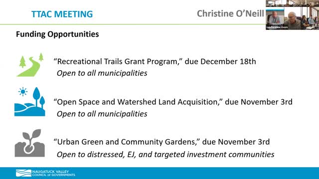
Summary
Staff highlighted several open grant opportunities — the Recreational Trails Program (due Dec. 18), Open Space and Watershed Land Acquisition (OSWA, due Nov. 3) and the Urban Breathe/Community Garden grant (due Nov. 3) — and introduced a redesigned regional map viewer and new sidewalk/crosswalk data to support planning and grant applications.
Regional staff reviewed near-term funding opportunities and demonstrated new mapping tools for municipal use.
Christine outlined grant opportunities: Connecticut DEEP’s Recreational Trails Grant round opened and applications are due Dec. 18; staff said roughly $10 million is expected to be available and projects can cover planning, design, construction and maintenance with a 20% local match. The Open Space and Watershed Land Acquisition (OSWA) program is due Nov. 3 and offers up to 65–75% of a property's fair market value (higher for environmental-justice communities) and typically requires a larger application; the Urban Breathe and Community Garden grant (due Nov. 3) targets distressed and environmental justice communities for green-space projects with a 50% match requirement.
Staff said the regional team can provide mapping, letters of support and technical assistance for applications. Grant details and deadlines were circulated to members earlier.
James from the mapping and data team reintroduced a redesigned online regional map viewer. He said the viewer consolidates prior datasets into an organized mapping format and includes new companion tools: a public-notification/address-list tool (able to export neighboring-town addresses), an aerial imagery swiper for comparing years, and updated sidewalk and crosswalk layers derived from a 2023 countywide flyover. He noted the sidewalk/crosswalk dataset will be used in conjunction with CTDOT’s ADA work and could support municipal ADA transition planning.
Staff offered to share geographic data layers on request and to work with municipalities on dataset choices; questions about publication of local official wetlands layers were deferred to the regional coordinator. No formal actions were taken; staff encouraged towns to reach out for help preparing grant applications or to arrange demonstrations of the map viewer.