Get Full Government Meeting Transcripts, Videos, & Alerts Forever!
Clark County planning staff propose LTS-based multimodal standards for Vancouver UGA; say costs, rights-of-way and funding will shape rollout
Summary
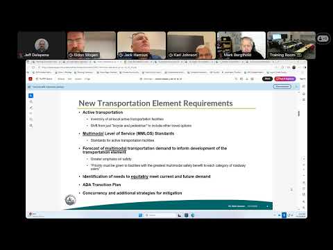
Clark County planning staff on Oct. 16 recommended using a Level of Traffic Stress (LTS) metric to set multimodal level-of-service standards for active transportation facilities inside the Vancouver urban growth area, and to apply a narrower set of standards on two rural regional routes, telling the Planning Commission the change will add projects to the 20-year capital facilities plan and raise planning-level costs.
Clark County planning staff on Oct. 16 told the county Planning Commission they intend to use a Level of Traffic Stress (LTS) metric to set multimodal level-of-service standards for active transportation facilities as part of the ongoing comprehensive plan update, proposing an LTS 2 target inside the Vancouver urban growth area and a more flexible LTS 3 for a small number of rural routes on the regional active transportation network.
The proposal, presented by Harrison Houston, a transportation planner with Community Planning, is intended to satisfy new requirements in state law (House Bill 1181) and changes to the Growth Management Act that direct local jurisdictions to adopt multimodal performance measures and inventory active transportation facilities. "LTS is a grading system that's based on a user's comfort and perceived safety or stress level, and it's supposed to capture how one might feel while they're using a facility," Houston said during the work session.
County staff and their consultant recommended LTS because it is already used by WSDOT and regional partners and is easy to map and visualize. Staff showed a systemwide LTS analysis for collectors and arterials and said it would be applied first to roadways inside the unincorporated Vancouver urban growth area (Vancouver UGA) and to two rural segments that are on the Southwest Washington Regional Transportation Council's (RTC) Regional Active Transportation Network: 70th Avenue and Northeast 10th Avenue. Highway 99 and similar high-speed corridors, staff said, typically rate as LTS 4 under current conditions and would require separated facilities (for example a shared-use path or…
Already have an account? Log in
Subscribe to keep reading
Unlock the rest of this article — and every article on Citizen Portal.
- Unlimited articles
- AI-powered breakdowns of topics, speakers, decisions, and budgets
- Instant alerts when your location has a new meeting
- Follow topics and more locations
- 1,000 AI Insights / month, plus AI Chat