Portage Planning Commission approves 60‑unit Portage Premier Preserve after debate over contaminated parcel and access
Loading...
Summary
After a public hearing featuring neighborhood opposition, the Portage City Planning Commission approved a conditional use permit, certified survey map and site plan for Pre 3's Portage Premier Preserve, a five‑building, 60‑unit apartment project on Parcel 6022. Commissioners debated access, an identified historic landfill on a 1.98‑acre portion of
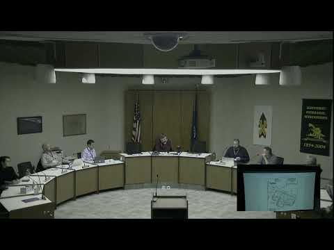
The Portage City Planning Commission on Thursday approved a conditional use permit, certified survey map (CSM) and site plan for Portage Premier Preserve, a proposed five‑building, 60‑unit apartment development on Parcel 6022.
The decision followed a public hearing in which a nearby resident, Michael Watson of 844 Suwon Lane, urged commissioners to reject the project. "If an apartment complex is built on Parcel Number 6022, our single family home and those of our neighbors will experience a devaluation," Watson said, citing concerns about flooding, wildlife loss and neighborhood character.
City staff presented the application and findings, noting that the multi‑family project exceeds 40,000 square feet and therefore requires both a conditional use permit and large‑development review. The applicant, Pre 3 (represented by Bob Murray and Emily McFarland), proposed 5 buildings with 12 units each; staff memo and the applicant described each building as about 10,230 square feet. Staff recommended approval, concluding the proposal conforms with the comprehensive plan and will not impose undue public burdens if mitigation measures are applied.
A central point of the commission's discussion was a roughly 1.98‑acre portion of the parcel that testing showed contains historic landfill material. The developer said subsurface testing identified landfill fill during phase‑2 work and that the team chose to avoid disturbing that area rather than undertake costly remediation. Bob Murray of Pre 3 said, "we are not going to develop on a dump," and described having pushed the developable portion away from the contaminated material.
To allow construction to proceed on the larger, non‑contaminated area while leaving the contaminated area in its current condition, the applicant proposed a CSM that creates Lot 1 (13.42 acres, the developable parcel) and Lot 2 (about 1.98 acres of contaminated material). Commissioners and some members of the public raised concerns that carving the contaminated portion into a separate lot could remove leverage for remediation and set a precedent for avoiding cleanup by parceling off problematic land. Several commissioners argued that the city could use tax incremental financing (TIF) or Brownfields grants to address cleanup costs later if development generates increment; others said the city should require a remediation plan as part of any development agreement.
Commissioners also questioned access and emergency vehicle circulation. Concerns included a single primary egress onto Dorothy Drive and the loss of a previously proposed exit to Albert Street after testing showed contamination in the southern portion of the site. Staff said the fire department reviewed turning radii and did not object to the proposed single egress so long as internal circulation allows emergency vehicles to turn around. Justin, the site engineer from Vierbecker, explained the access decision and said the narrower right‑of‑way to the south was not usable for standard access.
The developer described the project as workforce, market‑rate multifamily housing intended to be affordable relative to new single‑family construction, and said design choices and a repeat builder reduce costs. Pre 3 said it would pay the city's park fee rather than dedicate park land; the developer said the park fee is about $65,000.
Votes at the meeting recorded by roll call: the commission approved the conditional use permit (Feeney: Aye; Egan: Aye; Voss: Aye; Paul: Aye; Schneider: Aye; Dulick: Aye), approved the CSM (Feeney: Aye; Egan: No; Voss: Aye; Paul: Aye; Snyder: Aye; Sulik: Aye) and approved the site's site plan (Feeney: Aye; Egan: Aye; Voss: Aye; Paul: Aye; Schneider: Aye; Sewik: Aye). Staff and the developer said utilities and an agreement over Grove and Houston street widths and responsibilities will be handled in a developer agreement.
Commissioners, staff and the developer discussed possible next steps if the city or a future owner pursues remediation for Lot 2, including applying for state site assessment/Brownfields grants, factoring remediation into TIF project plans, or negotiating remediation as part of a development agreement. Several commissioners said denying the CSM or site plan would likely leave the property undeveloped and remove the chance to generate increment for cleanup.
The developer asserted that if required to remediate before purchase, the project would be economically infeasible and likely would not be built, while commissioners emphasized that splitting off contaminated land without a remedial plan raises long‑term city obligations. The commission approved the motions as recorded.
The approval clears the way for Pre 3 to proceed with construction on Lot 1 subject to the developer agreement, permitting and the conditions in staff memos.