Get Full Government Meeting Transcripts, Videos, & Alerts Forever!
Get email alerts on the Dem Wetlands Access Right Of Way topic
No spam. Unsubscribe anytime.
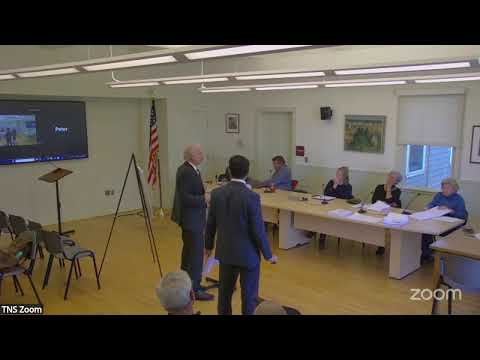
New Shoreham planning board hears debate over Blansfield Realty wetland alteration and right-of-way access
Summary
The New Shoreham Planning Board on Oct. 1 heard a contested application by Blansfield Realty Holdings LLC seeking an advisory opinion on a DEM wetlands application (No. 22-0340) that would alter a small part of a wetland to construct an access drive to landlocked Lot 136 off East Mansion Road.
The New Shoreham Planning Board on Oct. 1 heard a contested application by Blansfield Realty Holdings LLC seeking an advisory opinion on a Department of Environmental Management (DEM) wetlands application (No. 22-0340) that would alter a small part of a wetland to construct an access drive to landlocked Lot 136 off East Mansion Road.
The applicant’s attorney, Hamza Choudhury, told the board Blansfield owns Lot 136 and that title work from Pilgrim Title shows the only recorded legal access is a 40-foot platted right of way. Choudhury said the application would use a 10-foot driveway within that 40-foot right of way and that the plan “only proposes to modify 1.5% of the wetland,” an approximation the board compared to DEM’s stated disturbance figures (DEM’s notice dated Oct. 1 lists 0.05 acres of swamp and 0.03 acres of wetland).
The matter drew extended public and board discussion because Lot 136 — and an adjacent lot, 131 — are landlocked and the proposal would cross or abut mapped freshwater wetlands. The applicant team, including owner Jim Blansfield and the project surveyor, presented a plan they said minimizes impacts: a 10-foot pervious crushed-stone driveway, buried utilities, a native-stone retaining wall with restored vegetation, catch basins and culverts to convey stormwater back to the wetland, and a mitigation and monitoring program prepared by Avizinis Environmental Services and to be submitted to DEM.
Why it matters: The planning board’s advisory comments are part of the public record that DEM will use when it evaluates the permit application. Board members and neighbors pressed the applicant for feasible alternatives that would avoid wetland alteration, asked for clearer engineering and emergency-access details, and signaled they may send a recommendation that reflects unresolved concerns.
What the applicant said Hamza Choudhury described Lot 136 as landlocked and said a Pilgrim Title opinion (submitted to DEM) confirmed the deeded 40-foot right of way across Lot 138 as the only recorded way to reach Lot 136. Choudhury said the application reduces the disturbance footprint as much as possible and that the proposed work would not touch the C‑series wetland on the site: “we're not proposing to modify or impact the c series wetland whatsoever.”
Owner Jim Blansfield, who said his family has owned property on Block Island for decades, said the family has priced Lot 136 to enable sale to a local islander and described an intent — expressed privately to the buyer — to restrict resale at market rate for a period through deed language. Prospective buyer Kevin Hoyt, who described himself as a licensed DEM practitioner and environmental scientist with island experience, said the design follows DEM best practices and that the wetland complex is a revegetated depression tied to local contours and soils rather than a hydrologically expanding marsh. Hoyt said measures such as earthen swales, small catch basins, transplanting shrubs, and a monitoring plan are part of the mitigation approach.
Concerns raised by board members and neighbors - Alternatives: Several planning board members (including Claire and Jen) and the attorney for adjacent owners, Christopher Davidio, urged the applicant to show whether accessible, feasible alternatives exist that avoid wetland alteration — for example, using existing driveways, a right of way that could be created or granted by the owner of Lot 134, or continuing an already-approved access on Lot 138. Davidio emphasized DEM’s requirement that alternatives be explored and ruled out based on engineering feasibility, not cost or convenience. - Title and recorded easements: The applicant says title opinions submitted to DEM show no other recorded access; opponents pointed to plat map 7 (1961) and argued that recorded plats and lot geometry indicate other potential access paths. Both sides said they would supply relevant title and plat documents to the board for its advisory comments. - Wetland impact math: The applicant’s 1.5% figure was framed as an approximate percentage calculated from an estimated 85,000-square-foot wetland; board members contrasted that with the permit notice’s specific acre figures (0.05 and 0.03 acres) and asked for clarity. - Safety and road standards: Fire-safety officials and board members said a functional access for emergency apparatus requires wider standards than a narrow driveway. The applicant’s plan shows a 10-foot travelway with design elements intended to allow turning movements. Board members asked for explicit turning/hammerhead details and confirmation that the design meets emergency access and roadway standards if the driveway will serve multiple dwelling units or be used as a subdivision access. - Neighbor impacts and maintenance: Neighbors voiced concern about traffic through private yards, proximity of the proposed drive to existing decks and houses, and long-term maintenance of culverts and small catch basins. The prospective buyer said catch basins were sized and located to allow manual maintenance (no heavy equipment required) and noted the town’s limited vacuum/cleaning service schedule.
Board process and next steps No formal vote or final advisory opinion was taken at the meeting. Board members discussed preparing comments for the town council and DEM and asked staff and members (Jen and Peter) to draft language listing the board’s concerns and potential conditions. The board asked the applicant and both sides to provide documentary evidence (plat map 7, the Pilgrim Title letters, and any engineering alternatives) before a follow-up special session; members suggested holding that session the week following the meeting so the council can consider the board’s input before its early-November meeting. Public comment remains open to DEM until the notice period closes Nov. 17 at 4 p.m. (per the DEM notice).
What was not decided The board did not approve or reject the application and did not adopt conditions. Members were split: some said the materials as presented were thorough and minimized impacts, while others remained unconvinced that all feasible, non‑wetland alternatives had been exhausted. The board signaled it will prepare an advisory statement that includes the pluses, minuses, and unresolved questions for the town council and DEM.
Context The application targets access to two landlocked lots (Lot 136 and Lot 131) that the applicant said have been undevelopable without the recorded right of way. The proposal includes mitigation measures that will be overseen by the applicant’s wetland professional and a monitoring report submitted to DEM. The outcome ultimately depends on DEM’s technical review and any party’s legal claims about recorded easements.
Ending The planning board kept the matter open for additional evidence and directed staff and members to draft advisory comments to the town council and DEM. The public comment period to DEM is set to end Nov. 17 at 4 p.m.; the board asked interested parties to submit title and plat documents to be included in the record so the board’s advisory comments can address alternatives and technical questions raised at the Oct. 1 hearing.