Multi-agency network in Los Angeles tracks post‑fire water, finds metals and turbidity spikes
Get AI-powered insights, summaries, and transcripts
Subscribe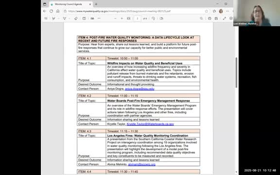
Summary
Following January’s wildfires in Los Angeles County, state, county and nonprofit teams rapidly sampled ocean water, beach sand and storm drains and reported short‑term spikes in turbidity and several metals, especially near drains downstream of burned structures.
Los Angeles — Following January’s wildfires in Los Angeles County, a coalition of state, local and nonprofit groups coordinated rapid post‑fire water and beach monitoring and documented short‑term rises in turbidity and metals in storm runoff and beach sand. The work combined field sampling, interagency review of thresholds and a public dashboard to help managers weigh public‑health and environmental risks.
The monitoring was carried out by a loose consortium of agencies and organizations led by the Los Angeles Regional Water Quality Control Board and coordinated in part by Southern California Coastal Water Research Project (SCCWRP), Heal the Bay, the State Water Board emergency management staff and public‑health partners. “We documented about 200 sites that are monitored in the areas directly or surrounding where the fire, broke out,” SCCWRP scientist Alvina DeQuinto told the council.
Why it matters: the monitoring helped local officials and public‑health agencies decide whether beaches should be closed, whether fish consumption guidance was needed and how recovery activities such as debris removal could proceed without making water quality worse. State staff said the work also supported expedited permitting needed to clear debris ahead of storms.
What agencies did: The Los Angeles Regional Water Board and county partners sampled ocean wave wash and storm drains at a dozen beach sites after rain events on Jan. 22, Feb. 6 and Feb. 18; the Board added additional samples after storms on March 13 and May 1 and contracted a laboratory to analyze chemistry from those samples. Analysts tested for metals, nutrients, polychlorinated biphenyls (PCBs), polycyclic aromatic hydrocarbons (PAHs), volatile organic compounds (VOCs) and, later, beryllium and hexavalent chromium. The region’s beach‑sand monitoring was handled separately by a contract laboratory that analyzed sediments for metals, PCBs and PAHs.
How results were interpreted: The Los Angeles team compared measured concentrations to U.S. Environmental Protection Agency recreational screening values and California‑specific screening guidance from OEHHA and DTSC when available. OEHHA staff assisted the regional board with screening‑level interpretation. The Board posted downloadable analysis matrices and lab reports, and SCCWRP and Heal the Bay built a public dashboard to integrate results from multiple samplers.
Headline findings reported to the council: - Turbidity and settleable solids spiked in stormwater and wave wash at several sites immediately after storms. That increase was the most consistent and immediate change reported across sampled locations. - Metals such as iron, manganese and aluminum were repeatedly elevated in runoff at sites downstream of burned areas and burned structures. Some sites showed higher arsenic concentrations in sand than the conservative recreational screening thresholds used for inorganic arsenic, but staff cautioned that the state’s inorganic arsenic screening level (0.04 micrograms per liter for recreation) is not directly comparable to the total‑arsenic results being reported and that background soil arsenic in Southern California is generally higher than the conservative screening number. - Beach‑sand testing showed arsenic concentrations above a conservative residential soil screening number at a few locations; Board staff noted those concentrations were within published Southern California background surveys and consistent with natural soil levels reported for many coastal areas. - PCBs and some PAHs were largely nondetect or at low concentrations in the water samples collected by the regional board contract lab; separate work and targeted testing in the Camp Fire and other Northern California fires detected PAHs in runoff where structure loss was extensive.
Emergency coordination and permitting: State Water Board emergency staff briefed the council on the State’s role in incident coordination. Crystal Taylor, who led coordination from the State Water Board’s Emergency Management Program, said the board’s role is a supporting one: “Water board staff are not first responders, so we’re not acting in that capacity,” she said, and explained that boards serve as agency representatives in joint field offices and the State Operations Center. During the response, staff said the governor issued executive orders that temporarily altered permitting processes to expedite debris removal and recovery while smaller permitting questions were resolved.
Public‑health context: OEHHA and county public‑health staff used screening tools to assess potential recreation and fish‑consumption risk. OEHHA staff described use of the U.S. EPA risk‑screening calculator for recreational exposure, with conservative assumptions for repeated recreational contact, and recommended California‑specific values where applicable. Board staff said they would keep monitoring results, raw lab data and the jointly prepared interpretation tables available to the public.
Lessons learned and next steps: Coordinators said wide participation made the response faster and increased spatial coverage, but also added complexity because groups used different sampling protocols and analytic methods. SCCWRP, Heal the Bay and the regional board are building a shared data‑submission template and a public dashboard so agencies can upload results quickly and view integrated trends. Several presenters urged pre‑approved templates for methods and data formats, suggested a small set of default analytes for rapid deployment after fires, and pressed for clearer drinking‑water and fish‑consumption standards tied to the forms of contaminants that monitoring methods detect.
Officials also highlighted the importance of pre‑existing regional networks and agreed to continue developing a scalable approach for future fires so responders can plug local assets into a known monitoring framework quickly.
If you want to follow up: the Los Angeles Regional Water Board has posted lab reports and an interpretation matrix on its website; SCCWRP and Heal the Bay are coordinating a public dashboard and data‑submission templates for the affected beaches and watersheds. Contact information for the lead presenters is available in the council agenda and on the Board’s webpage.
Ending note: The Los Angeles work underscores two early takeaways for post‑fire response — immediate, visible sediment and turbidity effects appear most consistently after storms that follow fires, and metals and some urban‑derived organics can rise where structure loss is concentrated. Agencies said a combination of rapid coordination, shared data formats and a small set of pre‑agreed analytes will make future responses faster and more comparable for managers and the public.