Get Full Government Meeting Transcripts, Videos, & Alerts Forever!
Get email alerts on the Rezoning Murrysville Enterprise topic
No spam. Unsubscribe anytime.
Murrysville planning commission tables review after residents, staff raise questions about Parkland status of 3-acre lot
Summary
The Planning Commission postponed action on a rezoning request from Murrysville Enterprises after staff found mixed records about whether a roughly 3-acre parcel was dedicated as green space decades ago; neighbors said the parcel floods frequently and has been used like public land.
Murrysville Planning Commission members voted to close the public hearing on a request by Murrysville Enterprises to rezone a roughly 3-acre parcel (parcel 4911000129) from public land (PL) to R‑2 medium‑density residential and tabled the matter so staff can obtain legal and title advice.
Planning staff told the commission they could not find a deed conveying the parcel to the municipality and that meeting minutes from 1989 described the parcel as “green area,” but ownership records do not clearly show the land was ever deeded to the borough. Staff recommended more research and a solicitor’s opinion before the commission acts.
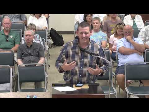
The uncertainty matters to nearby homeowners who said they had assumed the parcel was municipal parkland when they bought their properties. “I purchased our home in October 2020. It was marked as Parkland then,” resident Jason Leist said during public comment. He and other neighbors described repeated, significant flooding on the parcel and said children and families have used the area for recreation.
Commission staff noted meeting minutes from 05/02/1989 and council minutes from 05/15/1989 that reference Lot 14 as a green area and include a covenant restricting certain uses through a stated cutoff date, but staff also said the covenants on the record appear to have expired on 01/01/2000. “There’s some discussion of deeding it to the municipality, but there’s never a response to that question,” staff said. That ambiguity led staff to ask for another month to research deeds, covenants, and flood‑plain mapping and to consult the solicitor.
Residents who maintain the parcel told the commission they have kept the site clear and that both vegetation and flooding have worsened over the years. “The flooding is very severe on this land,” Larry Armstrong, who said he has maintained the parcel since about 1991, told the commission. Neighbors asked the commission to ensure any decision accounts for flood risk and ongoing maintenance responsibilities.
Commission discussion focused on two issues: the legal status of the parcel (deed and covenant history) and whether the borough can classify land as “public” in zoning where the municipality does not hold title. Staff advised the commission that the borough cannot unilaterally designate land as municipal property in zoning without title or an accepted dedication; that factored into the decision to table the request.
At the hearing’s close, a motion to table the matter and seek additional legal and title work carried; the commission will notify neighbors of the next steps.
What’s next: staff will pull deeds, plats and minutes, ask the solicitor for an opinion on the covenant language and deed history, and return with findings. The commission did not make a policy decision at the meeting and expressly deferred any rezoning vote until the legal status is clear.