Three Great Plain Avenue alternatives mapped: 4‑lane preserves capacity, 2‑lane widens sidewalks and shortens crossings
Get AI-powered insights, summaries, and transcripts
Subscribe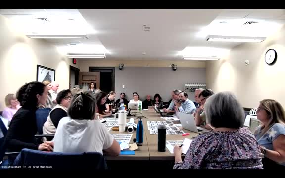
Summary
Consultants presented three concept plans for Great Plain Avenue (4‑lane, hybrid and 2‑lane) and an evaluation matrix showing tradeoffs in parking, sidewalks, crossing distance, traffic operations, stormwater opportunity and grant competitiveness.
Consultants from Apex Companies presented three concept alternatives for Great Plain Avenue on Sept. 10: a 4‑lane option that retains much of the current curb and pavement, a hybrid (three‑lane) option and a two‑lane option that reclaims roadway for wider sidewalks. The team showed plan graphics and a comparative matrix that evaluated safety, mobility, parking, streetscape, stormwater opportunities and grant competitiveness. According to the plan sheets, the 4‑lane alternative makes limited curb‑line changes and generally preserves capacity while adding targeted bump‑outs and modest sidewalk widening in places; crossing distances in some locations would drop from about 50 feet to roughly 30 feet where curb extensions are added. The hybrid and two‑lane alternatives produce substantially wider sidewalks (average widths shown increasing from about 9–10 feet in existing conditions to 15–16 feet in the two‑lane option) and shorter pedestrian crossings at key intersections—the consultants reported reductions from roughly 65 feet under existing conditions at the Chapel–Chestnut intersection to about 40 feet for the hybrid and about 32 feet for the full two‑lane layout. The consultants flagged operational tradeoffs: the 4‑lane plan was scored closest to existing traffic operations, the hybrid was presented as a compromise that keeps some turn pockets while widening sidewalks in places, and the two‑lane option was scored highest for pedestrian safety and placemaking potential but rated as likely to produce the most rerouting pressure if drivers change routes. Staff said new traffic counts, including school dismissal periods, were taken the day before the meeting and that draft traffic analyses will be incorporated into the next working group update. Design details drew focused questions. Participants asked whether pedestrian crossings would have exclusive pedestrian signal phases (staff indicated exclusive ped phases are likely for intersections that are close together), whether left‑turn pockets could be retained or reconfigured at certain intersections, and how signal phasing could be arranged to reduce queuing. Business owners sought clarity on construction staging and the anticipated duration of disruption; consultants reiterated that detailed phasing and mitigation measures will be developed during final design once a right‑of‑way decision is made. Stormwater and stormwater best management practices were discussed as part of design tradeoffs: plan graphics showed that the two‑lane design would create more space for street trees and vegetated bump‑outs that could host BMPs, while the 4‑lane plan would have fewer locations large enough for meaningful surface BMPs. Consultants recommended a pilot for the two‑lane options to test operations and community reaction before committing to hardscape design. No final design choice was made at the meeting.