Get Full Government Meeting Transcripts, Videos, & Alerts Forever!
Get email alerts on the Land Use Development topic
No spam. Unsubscribe anytime.
Planning commission finds proposed Rollins Ranch road realignment would harm neighbors, forwards findings to county commission
Summary
Morgan County Planning Commission voted unanimously to forward findings opposing a developer’s proposed road realignment in the Rollins Ranch amendment and asked the county commission to review the issue; speakers raised safety, traffic, drainage and property‑use concerns.
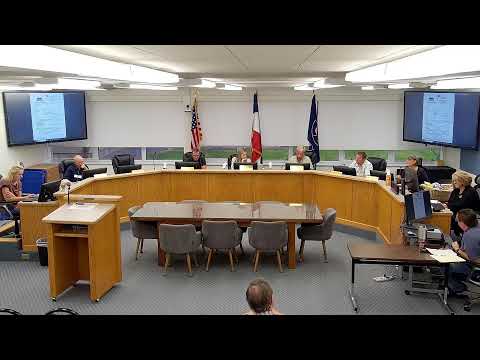
The Morgan County Planning Commission voted unanimously Thursday to forward a set of findings about a proposed road realignment in the Rollins Ranch development agreement amendment and to send the matter to the County Commission for final action. The commission’s recommendation followed more than an hour of public comment raising safety, traffic and property‑use concerns.
The item under review was application 25.037, described in staff materials as the Rollins Ranch development agreement fifth amendment, which would revise a road alignment on a roughly 250‑acre parcel near 6113 North Hidden Valley Road. Planning staff read a letter from the Mountain Green Fire Protection District that said the proposed Ponderosa Subdivision is approved and that the road alignment adjustments do not affect that approval; the letter also said an on‑site water flow test must be performed and witnessed before homes are built.
Why it matters: The commission’s findings will be advisory only. As Planning Director Jeremy (planning staff) explained, “we are appointed. We're not elected. We're not truly a legislative body, so we'll make a recommendation tonight... This will then go to the county commission.” Neighbors said the change would place a new road closer to existing homes, create “triple‑frontage” lots, increase traffic and speed through an area with many children, and could shift drainage onto private yards.
What commissioners and the public said: Dozens of residents and property owners addressed the commission during the public hearing. Dana Bauer said her “major concern is with code, 155.426” and warned that moving the road would create double‑ or triple‑frontage lots and directly affect existing homeowners. Paul Clayton, Robert Bunnell and other nearby homeowners said the realignment would place heavy construction traffic and a permanent new road very close to bedrooms and yards, worsening noise, headlights and flood risk. Robert Bunnell said the change would be “devastating and frustrating for my family” and described prior flooding into a neighbor’s home.
Ryan Gibson, general counsel for Browning (a neighboring property owner), asked the commission to remove language in a proposed plat (exhibit C1) that shows a “public right of way connections to Mountain Green Trail system” adjacent to Browning’s land and raised public‑safety concerns related to shooting ranges and reservoirs on that property.
The applicant, Tyrese (Durbano Group), told the commission the developer’s engineer recommended the alignment change for visibility and safety on a steep slope, saying the original alignment would create an “S curve” where parked cars would block sight lines. Tyrese said the engineer was a civil engineer (not a traffic engineer) and that no traffic study had been completed.
Staff and commission discussion: Planning staff said the amendment under consideration is limited to road alignment; utilities, lot sizing, drainage and easements would be addressed later in the preliminary plat process. Staff noted one phone call and one letter from neighbors had been received and that a fire district review letter arrived shortly before the meeting. Several commissioners and public speakers said the placement of an existing pump house (installed after an earlier concept plan) appeared to have prompted the requested change; one commissioner described that as a “self‑inflicted” complication that should not lead to adverse impacts on neighbors.
Formal action: Member Sessions moved a recommendation containing findings that the proposed alignment change would adversely affect neighbors, that safety concerns with the existing intersection could be mitigated with traffic control signage, and that the pump house placement was self‑inflicted and the road could remain where previously shown. Member Wilson seconded. The commission voted unanimously in favor; the motion carried. The commission’s vote is a recommendation that will be transmitted to the County Commission for final decision.
Next steps and conditions cited in the record: Staff said the next step is consideration by the County Commission (targeting the second meeting in September, depending on scheduling). The fire district letter in the record requires a witnessed water‑flow test once infrastructure is installed and warns that deviations from the water model could delay construction. Commissioners also asked staff to clarify and, if needed, correct the packet exhibits (multiple speakers noted the packet included an older concept plan and a mislabeled exhibit A). Browning’s counsel requested removal of trail‑connection language from the plat; the commission asked staff to investigate that exhibit so the correct map is included in the record going forward.
The commission closed the public hearing after hearing from residents, the applicant and counsel and adopted the motion sending its findings to the County Commission. The County Commission retains authority to approve, deny or modify the development agreement amendment.