Milford council tables 39-unit Truett Avenue townhouse plan after floodplain, parking and school-capacity concerns
Get AI-powered insights, summaries, and transcripts
Subscribe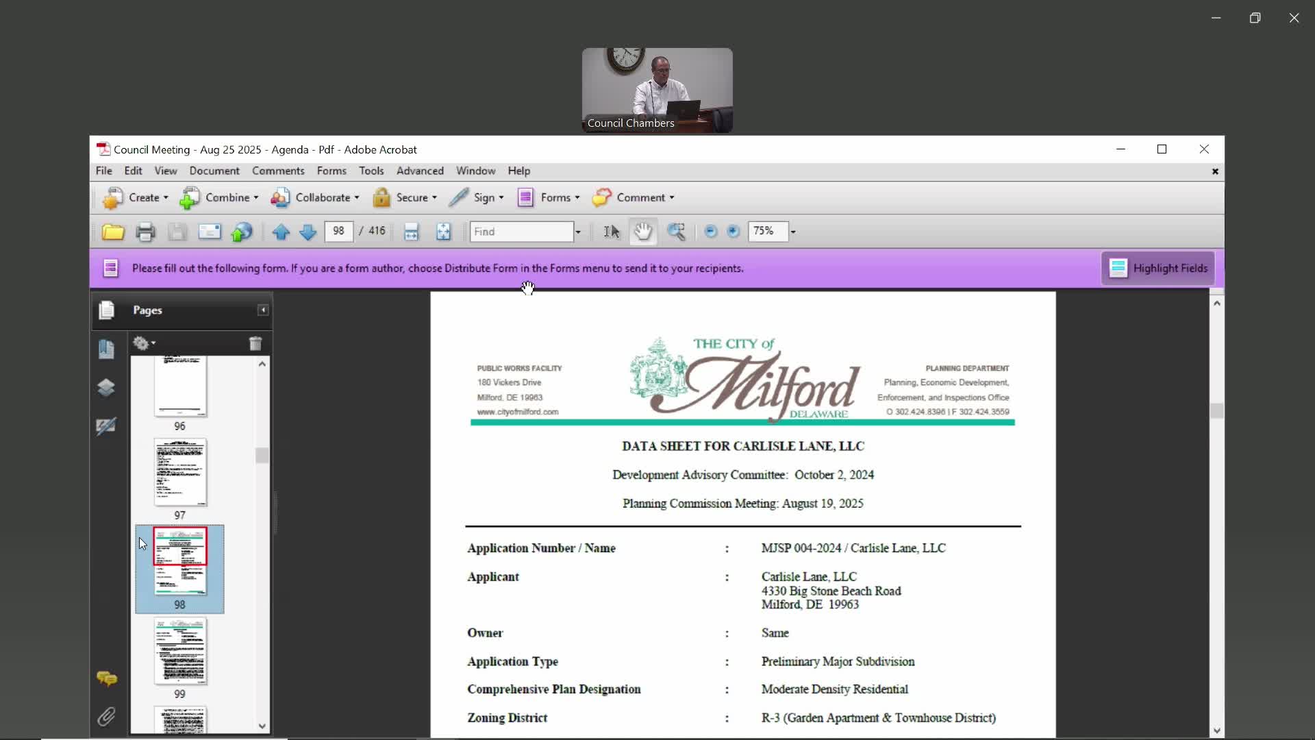
Summary
Milford City Council on Monday voted 7–1 to table a preliminary major subdivision application from Carlisle Lane LLC proposing 39 townhouses on the west side of Truett Avenue after residents and council members raised questions about floodplain mapping, on‑street parking and impacts on schools.
Milford City Council on Monday voted 7–1 to table a preliminary major subdivision application from Carlisle Lane LLC that would consolidate five parcels on the west side of Truett Avenue and create 39 townhouses and one single-family lot.
The council postponed action after a public hearing in which planning staff described waiver requests and the applicant presented engineering details that, the applicant said, avoid placing buildings in mapped floodplain and wetlands. Residents and council members raised concerns about parking, emergency access and the development’s effect on schools and on natural drainage.
Planning Director Rob Pierce told the council the proposal covers a little more than 4.5 acres and requests multiple waivers from the city’s subdivision code (chapter 200). Among items flagged in the staff report were a requested pavement-width reduction for Lilac Lane from 36 to 30 feet, a reduced right-of-way from 60 to about 43.34 feet, and permission to plat several lots whose rear yards would lie in the 100-year FEMA floodplain and within a 25-foot wetland buffer. Pierce said the applicant is also seeking a cash-in-lieu payment instead of on-site recreation open space and that an appraisal prepared May 5, 2025, valued the land used to compute the fee at $520,000; the required cash-in-lieu amount was listed in the staff packet as $55,084.75.
The packet noted the Board of Adjustment had approved 32 variances for the project on March 13, 2025, and the Planning Commission reviewed the application August 19 and recommended denial (4–1). Pierce told council that under chapter 200-4-83 a council vote favorable to an application that the planning commission recommended denying requires a three-quarters majority.
Engineer Edward Ide, speaking for the applicant, described site constraints that drove the design. He said the townhouses are proposed to avoid constructing any buildings within the floodplain and that grading and stormwater management were laid out to keep structures out of mapped flood elevations. He summarized technical points about distances between the proposed buildings and the FEMA flood line and said, “There are no buildings, no stormwater management facilities that are being built within the flood zone.”
Owner Matt Feint addressed the council, saying the project evolved over 15 years and that his team had designed the site to reduce density compared with an apartment option he said would fit on the site. He told the council he hopes the development will offer homeownership opportunities to current renters and asked councilors to “vote with what you think is best for this community.”
Several residents spoke in opposition. Resident Julie Morris, who said she filed a formal complaint with the Delaware Office of Public Integrity about unrelated behavior by a board chair, argued the proposal conflicts with the City’s comprehensive plan and warned of legal and safety risks from building near mapped flood areas. Morris cited a petition that by the meeting time she said had 408 signatures asking for a moratorium. Resident Trish Marvel and others said the project had changed in scope since first publicized, raising questions about transparency; multiple speakers pressed the council about on-street parking and whether the proposed roadway width and parking scheme would allow emergency access.
Supporters also spoke. Neighbor Jennifer McSorley, whose property borders the site, told council she favors infill growth and asked the city and developer to prioritize environmental protections and safety. Local developer Daniel Bond urged a longer review and suggested a council workshop to study density options and housing policy in Milford.
Applicant materials and staff testimony said the applicant proposes 2.5 parking spaces per townhouse (the design team said that total equals 100 on-site spaces plus additional alley and overflow spaces). The applicant also said no townhomes would be constructed within the mapped floodplain and that a Letter of Map Amendment (LOMA/LOMA) would be required prior to final approval to correct FEMA mapping errors noted by the applicant’s surveyor.
After extended discussion among council members about affordable and low‑income housing needs and the number of technical waivers requested, Council member Dan moved to table the application and set time to study the item further; Council member Katrina seconded. The motion carried 7–1 with one member absent. The planning commission’s record and the Board of Adjustment variances remain part of the file; the council did not approve or deny the application at the meeting.
What this means going forward: the council asked staff to set a date for a workshop to examine the project’s technical questions — parking and emergency access, floodplain and wetlands interactions, the cash‑in‑lieu option for recreation land, and school‑capacity impacts — and for the applicant to provide any additional documentation requested by council. The public record on the application remains open pending the council’s next steps.
Speakers quoted in this story are those who addressed the council at the public hearing or during deliberations and are identified in the record.