Get Full Government Meeting Transcripts, Videos, & Alerts Forever!
Get email alerts on the Land Use Rezoning topic
No spam. Unsubscribe anytime.
Bridgeton council rezones 521 acres from R‑1 to M‑1; residents raise floodplain and fill‑site concerns
Summary
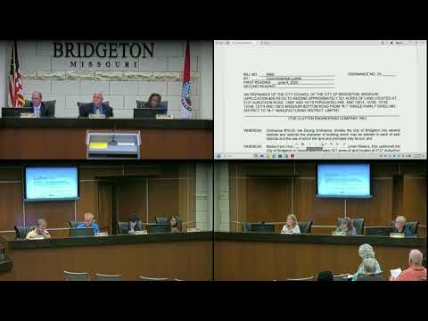
The Bridgeton City Council on June 18 approved reclassifying about 521 acres along Missouri Bottom Road from R‑1 (single‑family) to M‑1 (manufacturing), advancing application 25‑PZ‑03 into ordinance 25‑20.
The Bridgeton City Council on June 18 approved reclassifying about 521 acres along Missouri Bottom Road from R‑1 (single‑family) to M‑1 (manufacturing), advancing application 25‑PZ‑03 into ordinance 25‑20.
The change covers parcels listed in the rezoning application including 5137 Abishon Road; 13897 and 14175 Ferguson Lane; and multiple properties on Missouri Bottom Road (13674, 13728, 13738, 13748, 13774 and 13812). Council Member Luke moved to adopt bill 6495 as ordinance 25‑20; Council Member Hood seconded the motion and the council approved it by roll call, 7‑0.
Why it matters: Rezoning to M‑1 allows the uses listed for the M‑1 Manufacturing District. City staff and the city attorney emphasized that rezoning alone does not authorize specific uses that require additional approvals; if a property owner seeks to operate a clean‑fill site or another industrial use, the owner must apply separately for the specific approval (for example, a special use permit) and satisfy technical and agency requirements.
Public comment and concerns: A resident, Miss Fisher, spoke during public comment, saying she was “actually here talking about the 521 acres, which is gonna be filled in apparently with clean waste” and asked whether the material would be confined to “clean fill,” whether the site could later be converted to other disposal uses, and how fill placed on a floodplain would be protected from washing away. She also raised questions about three planned airport disposal sites in St. Louis County, proximity to the Westlake area and whether federal or state agencies (she asked specifically about EPA notification) had been or would be contacted.
Staff and legal response: A city staff member, Mister Greitens, explained that the item before council was only a rezoning request: "If council approves it, anything in the M‑1 District, whether permitted by right or permitted by special use permit, those uses are now permitted." He said uses that require a special use permit would return to the planning commission and city council for review and that council could attach conditions to a special use permit.
The City Attorney expanded on process and technical approvals. He cautioned against assuming a particular future use and noted the M‑1 code includes many permitted uses by right and a substantial number of uses allowable with a special use permit. He described the subsequent steps if a clean‑fill operation were proposed: an applicant would need to apply for the specific use (special use permit), and before any soil movement could begin the applicant would need a site disturbance permit and to demonstrate approvals from the Missouri Department of Natural Resources, the Metropolitan Sewer District and the Missouri Bottom Levy District, where applicable. The attorney also noted that Missouri Bottom Road is a St. Louis County road and the county would be notified during a special use permit review.
Council discussion and planning context: Council Member Luke asked when traffic, road impacts from fill trucks and environmental effects tied to displacing floodplain water would be analyzed; staff and the attorney said those issues would be evaluated during any special use permit and site‑disturbance reviews. Luke also suggested the comprehensive plan update should consider the larger floodplain area and coordinate with landowners on long‑term planning; staff confirmed that the city's current 2013 comprehensive plan shows the area as industrial or utility on the future land‑use map.
Council Member Hood told the public speaker the site “has absolutely nothing to do with what's going on with the airport,” calling the rezoning a private developer initiative to raise the area for future development. Council Member Sottel said one‑acre R‑1 residential lots are not feasible in that floodplain and supported the rezoning to M‑1 given surrounding development.
Outcome and next steps: By vote of 7‑0 the council adopted ordinance 25‑20 to rezone the listed parcels to M‑1. That change allows the broader set of M‑1 uses under the zoning code, but any specific industrial use that requires a special use permit or site‑disturbance permit would be reviewed separately and could be conditioned by the planning commission and city council. Agencies the applicant would need to show approvals from include the Missouri Department of Natural Resources, Metropolitan Sewer District and the Missouri Bottom Levy District; county review is expected for impacts to Missouri Bottom Road.
The council and staff flagged the comprehensive plan update as the appropriate venue to consider floodplain‑wide policy and long‑range land‑use goals for the area.