Get Full Government Meeting Transcripts, Videos, & Alerts Forever!
Get email alerts on the Comprehensive Plan Update topic
No spam. Unsubscribe anytime.
Planning commission unanimously forwards updated comprehensive plan to council, adds small Highway 21 corridor amendment
Summary
The Planning and Zoning Commission voted unanimously May 1 to send an updated comprehensive plan and future land use map to City Council, after staff and consultants described a revised growth-potential map and public outreach. Commissioners added a narrow amendment to mark a Highway 21 corridor as a commercial/mixed-use transition.
The Bastrop Planning and Zoning Commission voted May 1 to forward a revised comprehensive plan amendment — including changes to the future land use map and growth potential map — to City Council for adoption, with a minor, commissioner-backed amendment to adjust the land‑use designation along a short portion of Highway 21.
The commission’s unanimous recommendation sends the plan to City Council for readings later in May; staff said the revision reflects nine months of outreach, public workshops and a joint P&Z–council open house.
Why it matters: The comprehensive plan guides where the city and its partners prioritize infrastructure, parks, commercial services, and development standards. City and consultant presentations emphasized that the update is a high-level guide — not a zoning change — intended to steer future decisions on plats, infrastructure investment and targeted code updates.
What staff and the consultant said: James (city planning staff) told the commission the update aligns Bastrop with regional growth trends and called the document “the foundation for the future growth.” Ilda Capricioso of Half Associates summarized technical work used to shape the map, including existing land‑use inventories, hazard overlays (floodplain and wildfire risk) and a growth‑potential algorithm that considered parcel size, utility availability and other factors. She said the updated map responds to public input by adding more neighborhood‑residential areas, clarifying downtown distinctions between commercial and residential, and extending a “mixed‑use corridor” west of the Colorado River.
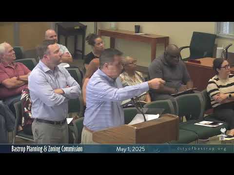
Discussion and public input: Commissioners and a handful of residents discussed downtown character and protections for established residential blocks. Heather Green, a downtown resident, urged the commission to preserve residential character and recommended a future overlay to limit incompatible uses downtown; commissioners agreed those policy tools could be pursued alongside the map.
Key amendments and highlights: The commission asked staff to mark a short stretch adjacent to Highway 21 as a commercial/mixed‑use transition (a red/blue corridor on the map) to reflect existing highway‑front businesses and better guide future development. Staff also said the plan does not change existing uses or immediately alter property rights; instead it will be used when developers submit rezoning, plats or site plans.
Process and next steps: The commission’s recommendation will go to City Council for consideration at its May meetings; staff said a draft of the development agreement and related documents is publicly available in council packets and a fully executed development agreement will be published when complete. Consultants and staff encouraged continued public engagement and said the city will follow up with maps and meeting notices; staff also offered to gather contact information from interested residents for targeted outreach.
Vote and timing: The commission’s vote to forward the comprehensive plan update to City Council was unanimous. Staff said the item will be before council for readings in mid‑ and late‑May.