Get Full Government Meeting Transcripts, Videos, & Alerts Forever!
Get email alerts on the Future Land Use Map topic
No spam. Unsubscribe anytime.
Bastrop reviews draft future land-use map; residents press to expand historic district
Summary
City staff and a consultant presented revisions to chapters 2 and 5 of Bastrop's comprehensive plan at a joint workshop on April 24. The draft future land-use map shifts growth expectations, prompts debate over the property behind Buc-ee's and downtown protections, and sets a May schedule for formal hearings.
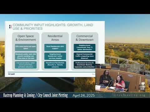
Bastrop officials and residents discussed a revised future land-use map and related changes to chapters 2 and 5 of the city92s comprehensive plan at a joint Bastrop City Council and Planning and Zoning Commission workshop on April 24, 2025. Ilda, a consultant with Half and Associates, presented the draft update and the growth-potential analysis to the joint meeting.
The workshop focused on where the city92s recent population and development growth is concentrated and how the comprehensive plan should guide future public investments. "The purpose of this update was really to look at the future land use map," Ilda said, describing a process that began in August 2024 and included public surveys, stakeholder meetings and multiple presentations to boards.
Why this matters: City staff and the consultant said the draft map is intended to guide capital improvements and planning recommendations, not to act as zoning law. The map and accompanying policy changes will inform water, sewer and roadway planning as Bastrop manages growth spilling east from the Austin area.
Key findings and proposals
- Population and land-use changes: The consultant reported Bastrop's population is already above the water-demand plan projection (about 14,700 compared with a projected 11,0009612,000), and that single-family residential growth has increased substantially. Retail/commercial land share rose from about 7.2% to 9.9% of the city limit area, while agricultural/rural land dropped from roughly 30% to about 11% in recent years.
- Growth-potential mapping: The draft includes a growth-potential analysis that flags parcels with higher likelihood for near-term development based on utility access, major thoroughfare connections and parcel size (10 acres or greater). Areas constrained by hazards such as flood risk or wildfire were marked as lower potential.
- Land-use guidance: The draft spreads a "mixed-use corridor commercial" designation along several highways (including U.S. 71), retains a form-based downtown core intended to allow a mix of commercial and residential uses, and reserves east-of-river areas for residential conservation to protect tree canopy and habitat.
Points of debate raised by commissioners and residents
- Property behind Buc-ee92s: Multiple council members and residents pressed to tighten definitions for the orange "residential mixed density" category covering parcels near the Buc-ee92s corridor. One resident said the parcel has been "a very hot button in the community" and urged the map and policy language make clear that large multifamily projects or corridor-scale commercial would not be allowed there. Concerns centered on traffic impacts, protection of mature pine stands ("the pines") and whether the map92s color coding expresses an enforceable limit or only an aspiration.
- Binding effect and code alignment: Staff and commissioners repeatedly stressed that the future land-use map is aspirational, not a zoning map, but that it is used when staff writes recommendations on rezonings and when the city schedules capital improvements. As one staff speaker put it during the meeting: the future map "is not a regulatory map" but it shapes what planning staff and the commission recommend to council and what infrastructure is sized to support.
- Downtown and historic protections: Public commenter Pablo Serna urged expansion of Bastrop92s historic district beyond the current two-street core and asked the city to pursue certified-local-government status with the Texas Historical Commission to access preservation tools and tax incentives. Several speakers asked that downtown and areas with historic grid patterns be described clearly in the plan so residents understand what is intended to be preserved.
Public engagement and next steps
Participants discussed outreach tactics to increase public participation in the final review: displaying large maps at H-E-B, the public library and events, adding QR codes and posters, and targeted mailers tied to utility billing. Staff said the draft will be revised based on the workshop comments and returned for formal review. The Planning and Zoning Commission is scheduled to consider the update May 1; City Council hearings are scheduled for May 13 and May 27, 2025.
Other public remarks
Local business owner Carlos Liriano urged the city to reserve suitable land for larger community needs such as a hospital, saying available developable land is finite and decisions now affect long-term options. Several residents and council members suggested more educational materials and pop-up outreach to explain how the future land-use map differs from zoning and how proposed changes could affect neighborhoods.
Ending
The workshop closed with staff saying they would incorporate the meeting92s feedback and return a revised draft. The meeting concluded with a routine motion to adjourn.