Get Full Government Meeting Transcripts, Videos, & Alerts Forever!
Get email alerts on the Residential Development topic
No spam. Unsubscribe anytime.
Architectural review board previews Reserve at Wildwood plans, raises stormwater and street-width concerns
Summary
The Wildwood Architectural Review Board on April 10 held a preliminary review of architectural elevations, 3‑D renderings and floor plans for five “designer‑series” homes that are part of the Reserve at Wildwood project on the 50‑acre site near Route 109.
The Wildwood Architectural Review Board on April 10 held a preliminary review of architectural elevations, 3‑D renderings and floor plans for five “designer‑series” homes that are part of the long‑running Reserve at Wildwood project on the 50‑acre site near Route 109.
Board members, city planning staff and a McKelvey Homes representative discussed site history, city design standards and infrastructure questions including stormwater management, fire‑department access and where sidewalks and multi‑use trails will connect to adjacent properties. No formal action was requested or taken; staff asked the builder to provide additional material samples and full 360‑degree home views at the next review.
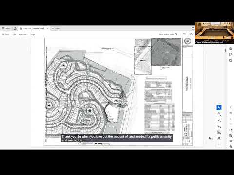
The project has been under discussion since about 2015 and has changed repeatedly under different builders. Planning staff described the current submission as the lowest‑density version proposed for the site, with the packet presented to the board showing five design variations that would occupy part of a larger subdivision. The city’s site‑specific ordinance for the town‑center area prescribes several architectural requirements that apply to this proposal: no vinyl siding, front porches at least 5.5 feet deep with a step up from sidewalk grade, carriage‑style garage doors with windows, full‑bed masonry (brick or stone) where provided, 9‑foot interior ceiling heights and architectural roofing with a minimum 30‑year warranty.
Staff told the board that Metropolitan St. Louis Sewer District (MSD) has signed off on the stormwater approach, which relies in part on stacked basins that consolidate channel protection, flood mitigation and water‑quality functions. Staff warned that stacked basins are deeper and require steeper slides and active vegetation maintenance; they also noted watershedwide erosion and occasional flooding in other creeks in the city. Staff said the city hopes to begin a citywide stormwater master plan later in the year.
Metro West Fire Protection District also has been involved. Planning staff said the fire marshal recently approved the hydrant ordinance and requested changes to street design. As a result, the city and developer adjusted the street section to 26.1 feet in some locations so parking will be allowed on one side of the street while maintaining a passable emergency lane; wider curb‑to‑curb sections would be required to permit parking on both sides. The fire marshal also recommended removing several speed humps along Main Street.
The developer described the product mix: the “designer” series shown are wider plans (approximately 68 feet wide in the packet) with three‑car garages; a separate “Liberty” series will include narrower plans (two‑car models starting around 1,800 square feet and optional three‑car variants). The presenter said some designer plans will reach roughly 3,600 square feet and that builder pricing could put designer homes in the high‑six‑hundreds to mid‑seven‑hundreds (dollars) depending on finish selections; the presenter explicitly framed those figures as preliminary estimates.
On connectivity, staff said the development will include sidewalks on cul‑de‑sac streets and a multi‑use trail through the site. The developer will be required to build a trail connection to the Phillips 66 corner and an existing tunnel that connects to the broader trail system toward town center; staff noted one pedestrian gap east of the site remains because previously awarded federal grant funds and local matching funds are not yet in place. The packet also shows parks, a playground and gazebo locations; planners said the majority of interior trees will be newly planted while perimeter trees along Bottom Creek and other boundaries are being preserved where feasible.
Board members asked for additional material samples and more complete model presentations at the next review. Planning staff requested at least one full 360‑degree view of a model from each series at the follow‑up meeting so the board can assess side and rear elevations and corner‑lot treatments.
The board took no formal action on the design packet. A procedural vote to approve March 13 minutes was recorded earlier in the meeting by voice; the minutes were approved by voice vote. The board scheduled a likely next review for May 8 and directed the applicant to return with the additional materials the board requested.