Get Full Government Meeting Transcripts, Videos, & Alerts Forever!
Get email alerts on the Land Use:brickyard Commons topic
No spam. Unsubscribe anytime.
Auburn Planning Board delays Brickyard Commons, asks for hydrogeologic and soil studies after public raises contamination, stormwater and traffic concerns
Summary
After extended public comment about spills at adjacent industrial sites and detailed technical discussion about shoreland, stormwater and parking, the Auburn Planning Board voted to require hydrogeologic and soils studies and postponed a decision on the 96‑unit Brickyard Commons project.
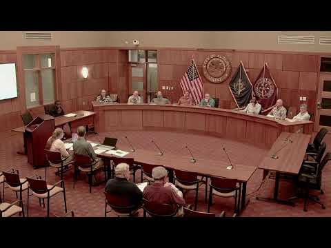
The Auburn Planning Board on May 13, 2025 voted to delay further action on the proposed 96‑unit Brickyard Commons housing development and asked the applicant to provide hydrogeologic and soils studies after residents and board members raised concerns about groundwater contamination, stormwater treatment, shoreline buffers and traffic safety.
The request for studies and the postponement came after more than two hours of technical presentation by the applicant’s engineering team and lengthy public comment from neighbors and abutters. The board first voted 5–2 to require a hydrogeologic study with soil contamination analysis, and later unanimously voted to postpone the application until the studies (or an update on them) are provided to the planning department.
Why it matters: The Brickyard Commons site abuts Taylor Brook, a waterway under local and state environmental attention; residents and conservation advocates said the project could undermine prior restoration work and that the parcel lies downstream from multiple reported spills at a neighboring commercial site. Board members expressed concern about whether existing state permits and the developer’s proposed stormwater measures are sufficient where contaminated soils or groundwater might be present.
The applicant’s team described stormwater controls and site grading. Michael Bonds, civil engineer with Maine Land Development Consultants, said the design uses two stormwater treatment systems intended to capture runoff from paved areas and treat "a minimum of 95% of the water that touches the paved area" through filter beds and detention before discharge to Taylor Brook. He told the board that the system includes an impermeable liner under the filter bed (10‑mil) and underdrains and that the treated water would be detained and released at predevelopment flow rates.
Residents pushed back on several technical and safety points. Carol Lane of Albania Street said the project threatens habitat and fish passage work funded in part by a NOAA grant, saying, "this development could undermine those efforts." Renee Cody, who reviewed Department of Environmental Protection (DEP) records, pointed to an environmental covenant from 2010 covering part of the adjacent Savage Safe Handling site and a 2020 compliance review; she urged the board to require a hydrogeologic survey before permitting any residential use near documented spills.
Other public commenters cited traffic and sight‑distance risks on Brickyard Circle and Washington Street, and urged more current traffic data than the developer’s study (published May 5, 2022). Multiple speakers—Marcel LaRose and another resident who identified himself as having worked at the adjacent property—described a history of reported spills at Savage and said the risks of a catastrophic release, however unlikely, merited additional study given the proposed residential occupancy.
Board members and staff reviewed how local shoreland and form‑based rules apply. Planning Department staff (Natalie, planning staff) summarized the Shoreland Overlay rules: the overlay is measured 75 feet from the normal high water line while the applicable General Development District within the overlay uses a 25‑foot structure setback. Staff and the applicant showed plan slides indicating building footprints and contours; Bonds said the proposed buildings are set well outside the ordinance's 25‑foot structure setback and that finished floor elevations are above the mapped floodplain (for example, Building 4’s pad was shown near elevation 215 versus a floodplain elevation of 204).
The applicant clarified project phasing and parking. The developer said the site would be constructed in two phases (buildings 1–4, then 5–8) and that parking is also being staged: the plan shows roughly half the parking built with phase 1 and additional spaces constructed later if market demand requires. The applicant reported a proposed parking ratio of about 1.75 spaces per unit (168 spaces proposed initially against a code minimum of about 120 for a 96‑unit project), with an option to expand to roughly two spaces per unit (193 total) if needed.
Board action and next steps: Planning Board member Maureen Hopkins moved that the board request a hydrogeologic study including soils analysis; the motion was seconded and the board later amended that motion to require both groundwater/hydro studies and soils contamination analysis. The amended study request was approved on a 5–2 vote for the studies (the amendment vote earlier recorded 6–1). Later the board voted 7–0 to postpone final action until the studies (or an applicant update about pursuing them) are submitted and noticed.
The applicant told the board he would consult the client and asked for about 30 days to decide whether to commission the studies; the board said it would accept an update at the next meeting and agreed to re‑notify abutters when the matter returns. The applicant also provided a written letter from Savage (the neighboring business) noting the company’s reporting history and saying they have no objection to the project as proposed.
The planning board did not approve or deny the site plan at the May 13 meeting; the board explicitly separated discussion (questions from staff, the developer and the public), direction (the board’s request for studies), and decision (formal postponement until the studies are provided).