Get Full Government Meeting Transcripts, Videos, & Alerts Forever!
Get email alerts on the Land Use And Planning topic
No spam. Unsubscribe anytime.
Simsbury planners present draft TerraFill neighborhood plan, seek public input
Summary
The Simsbury Planning Commission and consultant SLR Consulting presented draft recommendations for the TerraFill neighborhood plan, covering village character, river access, trails, sidewalks, zoning and a proposed traffic study, and asked residents for feedback at an open-house style meeting.
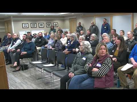
The Simsbury Planning Commission and consultant SLR Consulting presented draft recommendations for the TerraFill neighborhood plan at a public meeting in Simsbury and asked residents for written and verbal feedback on proposed changes to village character, parks and trails, multimodal connections and zoning.
The draft plan lays out five theme areas and a set of recommended actions intended to preserve the neighborhood’s historic and natural assets while improving access, safety and economic vitality. “These recommendations are still in draft form, so we welcome all your feedback,” Assistant Town Planner Britney McGilpin told the gathering. Consultant Robert Collins said, “we're here tonight to get your feedback and then to continue on with that before we finalize the recommendations.”
Why it matters: The recommendations would guide future capital projects, zoning updates and maintenance priorities for the TerraFill neighborhood, affecting road and sidewalk work, park improvements at TerraFill Park, river access to the Farmington River and the safety of routes used by elementary school children.
Key recommendations and details
Village character: The draft calls for defining and enhancing a distinct TerraFill village character through gateway features at primary entrances, improved streetscape treatments on Winthrop Street, Main Street and Elm Street, consistent signage and wayfinding, and updated style guidelines tied to a proposed village district zoning overlay. The consultants suggested a review of parking regulations specific to TerraFill and stronger property-maintenance emphasis to improve street-level appearance.
Outdoor recreation and river access: The plan highlights the Farmington River and the New England National Scenic Trail as neighborhood assets. It recommends promoting existing and improved public access points to the river, exploring designation of a Farmington River “blueway” (a water-trail designation), improving public views of the river and linking the village to nearby trails.
Parks: Short-term recommendations include continuing implementation of items from the Simsbury Park and Open Space Master Plan (February 2020) for TerraFill Park; longer-term work would include creating a park-specific master plan to guide investment and programming over decades.
Trails and student access: The draft recommends better connections between neighborhood trails, formalizing an unimproved right-of-way behind the elementary school as a structured trail connection into TerraFill Park, and adding trailhead signage and limited parking or pull-off spots where appropriate. David Vania of the Careful Village Association raised having students walk from the school to the river; staff and consultants pointed to the proposed formalized connection behind the school as the route being considered.
Multimodal safety and sidewalks: The plan calls for closing key sidewalk gaps in the village center, identifying a designated safe walking route to TerraFill Elementary School, joining the Safe Routes to School program and coordinating crosswalk and intersection improvements with the Connecticut Department of Transportation for Elm Street. The consultants also recommended a villagewide traffic study to identify and prioritize pedestrian, bicycle and vehicle safety measures; costs for that study were not specified.
Traffic calming and enforcement: Recommendations include a villagewide traffic study followed by implementation of priority traffic-calming measures. Consultants and staff noted that some road segments (Elm Street) are state-owned and would require coordination with Connecticut DOT, while local roads would be handled by the town’s Department of Public Works.
Economic vitality: The draft urges policies to support existing local businesses, attract targeted new uses through zoning updates, clarify parking locations with wayfinding, and promote an outdoor-recreation economy (for example, seasonal events or races that tie trails and river activities together). The report includes an implementation table with suggested short-, medium- and long-term steps, though the plan’s draft does not commit funding sources.
Public concerns raised during the meeting
Residents asked for clearer accessibility language for people who use wheelchairs; consultants said the more detailed recommendations include accessibility provisions and that DPW would help refine that language. Several participants described high speeds on Elm Street near the school and urged quicker action; the consultant recommended noting that crossing upgrades and beacons are potential solutions and requested those priorities be marked on the mobility station comment boards.
Other local concerns raised were deteriorating curbs along Winthrop Street and leaning Eversource poles; consultants said those maintenance issues should be added to station comments so staff can follow up with appropriate town departments and external utilities. The meeting did not include cost estimates for the traffic study or a firm implementation timetable beyond the plan’s short-, medium- and long-term framing.
Next steps: The presentation transitioned into an open-house format with four stations where residents could review maps and handouts, mark priorities and leave written comments. Consultants and staff said they will revise the draft recommendations after collecting station feedback and then present a final plan to the Planning Commission for further action.