Get Full Government Meeting Transcripts, Videos, & Alerts Forever!
Get email alerts on the Land Use Development topic
No spam. Unsubscribe anytime.
Planning panel presses applicant over riding-trail protections, pervious driveway and timber bridges at 45 Doverton Lane
Summary
Sabine Dolberchin LLC sought final site‑plan approval on March 11 for a residence, carriage house and related amenities at 45 Doverton Lane, a 20.54‑acre lot created by a 2013 subdivision; the Commission focused on recorded riding‑trail rights, drainage and septic siting, timber‑bridge details and maintenance for proposed porous paving.
Sabine Dolberchin LLC sought final site-plan approval on March 11 for a residence, carriage house and related amenities at 45 Doverton Lane, a 20.54‑acre lot created in a 2013 subdivision that the commission said carries special conditions because of environmental sensitivity.
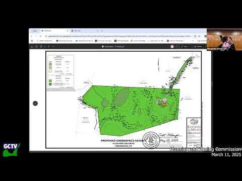
At the meeting Tom Hegney, attorney for the applicant, said the proposed development is “much more compact” than the subdivision plan approved in 2013 and that most of the parcel is held in conservation easement. He described moving septic and drainage closer to the house so lines need not be run to the lower left area of the property shown on the original subdivision map. “This is a much more compact and efficient development of the site than what was proposed in 2013,” Hegney said, adding the site retains 97.2% green space in the R‑2 zone.
Why it matters: commissioners flagged three areas of potential long‑term impact — public riding trails shown on the original subdivision mylar, how the driveway and motor court will be constructed and maintained, and the visibility and acoustic effects of timber bridges being proposed to cross wetlands — and sought firm commitments from the applicant and town staff before final sign‑off.
Trail rights and the mylar. Commissioners and staff reviewed the 2013 subdivision map and noted language on several lots that described some existing trails as ‘‘to be retained, removed, or relocated at the discretion of future lot owner.’’ Hegney said some lines shown on the original condition survey cross the subject lot and that the signed mylar filed in the town record includes proposed trails that the Greenwich Riding and Trails Association (GURDA) had approved at the time. Commissioners asked the applicant to show the existing trails on the final site plan and to add notes that identify which segments will be abandoned and how those abandonments will be physically marked (for example, with boulders), so the record will preserve which routes remain in perpetuity.
Drainage, septic and pervious paving. Brett Holdsworth, the project engineer, described two stormwater systems: permeable pavers for the motor court and a larger infiltration system at the rear, and he said wetlands staff approved a timber‑bridge approach to reduce wetland impacts. Commissioners pressed for a maintenance plan for the permeable pavers; Holdsworth said the owner’s manual and a recorded maintenance declaration will require five‑year inspections by a licensed engineer and vacuuming/cleaning as needed. As Holdsworth put it, the system “does need to get inspected every five years by a professional license[d]” engineer.
Timber bridges and emergency access. Holdsworth said the applicant proposes timber‑pile bridges instead of culverts to reduce wetland disturbance; the technique is more expensive but less invasive during construction. Commissioners asked for documentation from the bridge manufacturer about load capacity and fire‑apparatus access. “If we can get some … document or something from the bridge company … stating how much the weight these bridges can handle so we’re comfortable with this,” Commissioner Nick (last name not specified) said, adding that the commission needs assurance that at least fire apparatus or a pump‑up unit could safely reach the house.
Landscaping and conservation concerns. Hegney said his client prefers to plant some ornamental cultivars (peonies) that conservation staff suggested replacing with native pollinator plantings. Commissioners asked conservation staff (via the file and Jackie, the planner) to work with the applicant to find an acceptable compromise; the commission agreed that staff can review and resolve landscaping details rather than making them conditions of approval. Commissioners also recommended adding a note to the ZLS (zoning/landscape/site) drawings to show the riding‑trail locations and the documented abandonments so the town record and future owners have clarity.
Outstanding items and next steps. The commission left the record open for a revised site plan that shows the trails, clarifies the southern edge trail that the mylar indicates should be retained, adds the trail abandonment markings, and supplements the pervious‑pavement maintenance declaration. Hegney said the applicant will provide updated drawings and follow up on the timber‑bridge manufacturer’s load certification before returning to the commission.
End note: Commissioners emphasized the project’s smaller footprint relative to the 2013 approvals but made continued approvals contingent on clear trail documentation, a recorded maintenance plan for pervious pavement, and written bridge‑capacity evidence for emergency access.