Get Full Government Meeting Transcripts, Videos, & Alerts Forever!
Get email alerts on the Housing Development topic
No spam. Unsubscribe anytime.
Coos Bay examines housing, infrastructure options for 16-acre Bay Area Hospital opportunity site
Summary
City staff, state planners and consultants presented two concept plans for a roughly 16-acre parcel owned by the Bay Area Health District and solicited community input on housing, trail access and infrastructure costs; no formal decisions were made.
Coos Bay city staff, the Oregon Department of Land Conservation and Development and a consultant team outlined concept plans on April 2025 for the Bay Area Hospital Opportunity Site, a roughly 16-acre parcel the Bay Area Health District has declared surplus, and asked residents for input on housing, trails and infrastructure trade-offs.
The project team described two early concepts that differ on vehicle access, trail connections and engineering costs. Chelsea Schnabel, the city’s community development director, said the study aims to produce a concept plan and a feasibility analysis to present to the City Council and the Bay Area Health District board. “This project is really an example of community partnerships,” Schnabel said.
Why this matters: the parcel sits adjacent to the hospital campus and residential neighborhoods and could contribute to Coos Bay’s housing supply while also raising environmental and infrastructure questions. The concept work will inform whether and how the site could support housing of varying types, trail connections and other community amenities while remaining financially feasible for a developer or partner.
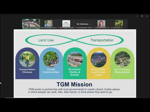
City and state roles and schedule The city is leading the project in partnership with the Bay Area Health District (the landowner) and the Oregon Department of Land Conservation and Development (DLCD), which is funding the work through its Transportation Growth Management (TGM) program. Nicole (Nikki) Cross, a land use and transportation planner with DLCD, described TGM as a grant program that channels federal and state transportation funds to local planning projects. “We provide grants for a variety of different planning efforts around the state,” Cross said, and added that DLCD funds site-specific “quick response” planning projects aligned with TGM objectives.
Schnabel said consultants from Cascadia Partners began evaluating the site in January, interviewed stakeholders in March and will refine concepts in May, with a feasibility analysis expected before the study wraps up late spring or early summer. She said consultants will present a final concept to the City Council and the Bay Area Health District board in July for consideration.
Two concept approaches and infrastructure trade-offs Consultants presented two conceptual layouts: an “out-and-back” option with a single vehicle access from Myrtle Avenue and a “through-hike” option with two access points that would require building a bridge across a ravine.
The out-and-back concept concentrates development near existing access but would likely require a sanitary sewer lift station to pump wastewater back up to the city system; the project team estimated a lift station cost in the range of $2 million to $3 million (current‑day estimate). The through-hike concept could allow gravity-fed sewer if a bridge is constructed to span the ravine, avoiding a lift station but adding bridge costs. Paul Rung, a Cascadia Partners consultant, said a full bridge could carry a multiuse connection and the consultant’s planning-level numbers put bridge work in the multimillion-dollar range: “If you build that bridge, then you can gravity flow the whole way.” Rung said engineers are using per-square-foot bridge estimates (on the order of about $500 per square foot in recent projects) to scope possible costs, but that the team did not have a final dollar figure yet.
Environmental and engineering constraints The site is forested and contains steep ravines and streams that may be fish-bearing, the team said. Schnabel said consultants identified roughly 7 acres of land that are more easily developed and an additional approximately 5.5 acres that would be more difficult but potentially developable; the remaining acreage is constrained by topography and natural features. Staff stressed that sections of the ravine are marshy or fed through culverts today and that options such as bridges versus culverts carry different environmental impacts and regulatory considerations.
Capacity and zoning Participants discussed rough capacity scenarios but emphasized that no final unit counts or developer has been selected and that feasibility testing remains to be done. Project staff and the fire marshal’s guidance discussed in the meeting suggested that a single emergency access can limit how many dwelling units can be served without additional mitigation; the fire marshal’s interpretation cited during the meeting indicated a single access could allow up to roughly 100 multifamily units plus about 30 single-family homes under certain conditions (for a notional total of about 130 units) depending on sprinklering and other safety measures. The consultant also noted that under the medical-park zoning, a mixed-use approach could allow higher densities, and one planning-level scenario discussed a notional upper bound near 200 units for a two‑access concept, but speakers emphasized these are planning-level estimates and that exact unit counts will be determined by later feasibility and financial analysis.
Community input and concerns Residents raised local concerns and suggestions. Mike Powder, who identified himself as a resident of Empire, urged more regular planning commission meetings, saying, “I think it should be once a month.” Other residents and commissioners asked about effects on local streets (Myrtle Avenue and surrounding blocks), emergency access for fire vehicles, visual buffering for adjacent uses such as a church and daycare, and potential impacts to trails and the natural environment. Staff said a future traffic‑impact analysis would evaluate required road mitigation and that the fire marshal had identified Myrtle as a route that can accommodate a fire truck, which is an initial threshold for access planning.
Next steps Project staff will collect public input via the online survey and refine the site concepts and the financial feasibility analysis in May. The study will return to the City Council and the Bay Area Health District board for consideration once the consultant completes the feasibility work.
No formal action or vote was taken by the Planning Commission at the April meeting; the presentation and public comment functioned as an information and engagement step in the ongoing feasibility study.