Get Full Government Meeting Transcripts, Videos, & Alerts Forever!
Get email alerts on the Water Quality Monitoring topic
No spam. Unsubscribe anytime.
Lake Forest Park volunteers, college interns map small tributaries to spot water-quality “hot spots”
Summary
A volunteer-led internship in Lake Forest Park is collecting early water-quality data across dozens of small tributaries to MacAlister and Lyon creeks, aiming to produce publicly available maps and identify local sources of pollution that could affect salmon habitat.
Brian Saunders, a Lake Forest Park resident and representative of the Lake Forest Park Stewardship Foundation and an instructor at North Seattle and Shoreline Community College, told the forum that a King County Water Works grant funded an internship to sample dozens of small tributaries feeding MacAler and Lyon creeks.
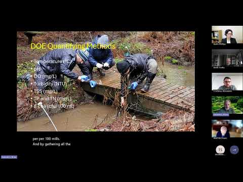
“The stewardship stream initiative ... is the beginning of what we call the use it program, which is the urban stream ecology internship,” Saunders said, describing a monthly sampling program that uses Department of Ecology methods and the Ecology water-quality index to score sites on eight parameters.
The student intern, Alex Cordova of North Seattle College, described field methods: a multi-parameter probe for pH, temperature, turbidity and dissolved oxygen, a colorimeter for suspended solids, and reagent/colorimetric tests for nitrates and phosphates. “We found the tributaries carry a lot of suspended solids and turbidity, and some streams bring low-oxygen water, especially where there’s decaying organic matter,” Cordova said.
Saunders said 12 students are participating in the first year; each student monitors several smaller tributaries, with most sites linked to an ArcGIS Survey123 dashboard that will publish month-by-month scores and parameter breakdowns. He noted the project is still preliminary — the group currently has about four months of data — and that the Department of Ecology index weights readings from salmon months (September–November), so the initiative expects to run at least two years to produce seasonal, actionable results.
The project uses the Ecology Water Quality Index (eight parameters including temperature, pH, dissolved oxygen, turbidity, total suspended solids, total phosphorus, total nitrogen and E. coli) to convert laboratory and field measurements into a 0–100 score. Saunders said the approach helps pinpoint which tributaries and which parameters most adversely affect the main stems.
Local municipal officials at the forum welcomed the volunteer monitoring as a potential tool for targeting limited stormwater and restoration resources. John Featherstone, Water/Wastewater Systems Manager for the City of Shoreline, noted the value of identifying upstream contributors in neighboring jurisdictions. Patrick Johnson, stormwater technician for the City of Edmonds, and other municipal staff said they would be willing to explore data sharing and partnership opportunities.
The internship team plans to present preliminary findings at the University of Washington Undergraduate Research Symposium in May and hopes to continue monitoring through the year that includes salmon presence to get Ecology-compatible scores. Saunders and Cordova said they are also working to make the underlying GIS dataset easier for municipal staff to export and analyze.
The presentation prompted questions about how third-party, volunteer-collected data can be integrated into city monitoring programs. Saunders and municipal staff agreed the data would be useful programmatically but cautioned that agencies typically treat volunteer data as one tool among many and may require documentation of methods and quality control before using it for enforcement or engineering work.
The project’s next steps include finishing the first season of sampling, refining phosphate testing protocols, building regression models to explore distance and confluence effects, and expanding outreach so residents know how to use the maps to spot problem spots in their neighborhoods.