Get Full Government Meeting Transcripts, Videos, & Alerts Forever!
Get email alerts on the Trails And Recreation Projects topic
No spam. Unsubscribe anytime.
Missoula staff detail Mountain View reroute, Republic Services loop and Duncan Drive trailhead plans
Summary
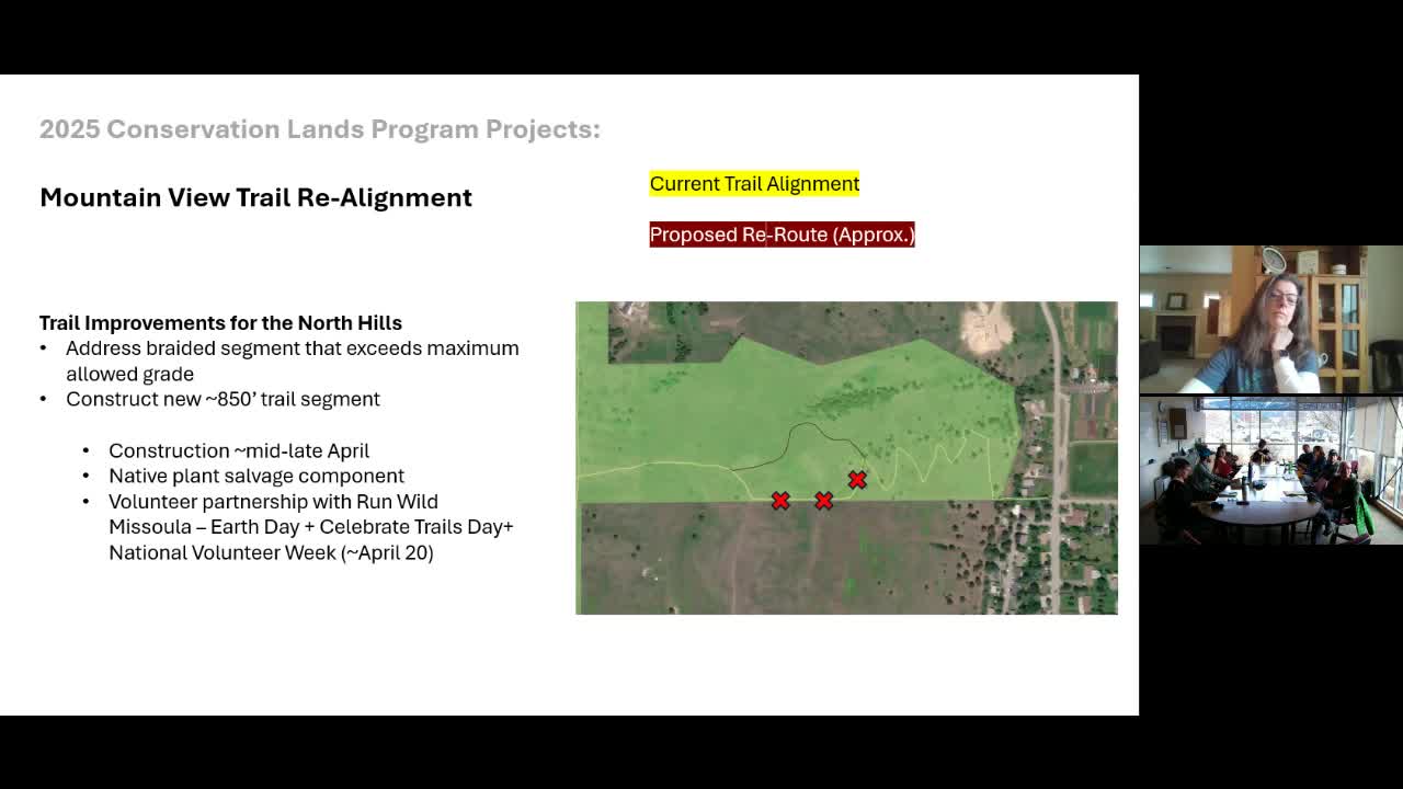
Conservation Lands staff outlined three lead trail projects for spring and summer: an 850-foot reroute on Mountain View Trail, a new loop on Republic Services land and a rebuilt parking and accessible loop at the end of Duncan Drive.
Missoula Conservation Lands staff told the Conservation Lands Advisory Committee they plan multiple trail projects this spring and summer, including a reroute on Mountain View Trail, a new multi-mile loop on Republic Services land and a redesigned Duncan Drive trailhead with parking and an accessible perimeter loop.
Peter, program specialist, said crews will reroute about 850 feet of the upper Mountain View Trail in the North Hills to reduce erosion and braided trails. The work is planned for early to mid-April and will rely heavily on volunteers; staff listed April 13 (weather permitting) and April 26 (Celebrate Trails Day) as targeted volunteer dates.
On the Republic Services property north of the landfill, Peter said the program expects to open roughly 5.5 miles of trail: the design uses existing service roads where possible and will add 3-to-4-foot single-track sections in places where the old roads are eroded or unsafe for pedestrians. Opening could be as early as June. The property will carry a seasonal closure from Oct. 1 to March 31; staff said those dates remain under discussion with Republic Services.
At the end of Duncan Drive, staff reported progress on a trailhead project funded by a state recreation trails grant. The plan includes a 15+-car parking lot, milling asphalt billings where feasible to improve winter traction and a one-mile, family-friendly loop trail to the old Rattlesnake Dam site on the west side of the creek. Peter said the project also includes three interpretive kiosks: one about Indigenous history and Robe Creek, one showing reused dam materials and one explaining restoration efforts visible from an overlook.
Why it matters: The projects aim to improve user safety, reduce resource damage from braided or eroded trails and expand public access. Committee members asked about trail uses, the status of bicycle access and easement constraints; staff said bikes are currently not allowed on the Republic Services preserve and that a 12-foot private-property easement near the switchbacks constrains realignment in one North Hills approach.
Staff requested continued volunteer support and said they would post sign-ups through the conservation newsletter and volunteeringtool.org. Peter said the work is being led by the city's projects and planning team for construction and supported by conservation lands staff for restoration and volunteer events.