Get Full Government Meeting Transcripts, Videos, & Alerts Forever!
Get email alerts on the Road Right Of Way topic
No spam. Unsubscribe anytime.
Council debates mapped Jowler Road corridor, developer offers shifted alignment and escrow for Tract A acquisition
Summary
City staff and council members discussed a developer proposal to shift the officially mapped Jowler Road corridor north, the implications for a small city-owned parcel called Tract A, and options for acquiring the remaining land needed to complete the corridor.
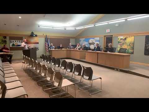
City staff and council members spent the meeting reviewing a developer proposal to shift the officially mapped Jowler Road corridor north of its current alignment near the Southdale soccer fields off Mount Nash and Jericho Road.
The discussion centered on whether the city should keep the existing official mapping that would require the developer to construct the road across a narrow area the city owns (Tract A) or allow the developer to move the 80-foot right-of-way north onto mostly private property and escrow money to allow the city to acquire Tract A if needed. Staff said the corridor was officially mapped in 2016 and that the city previously acquired part of the corridor from John Lemire to preserve future connection rights.
Why it matters: Jowler Road is planned as an east–west connector. Council members and staff said shifting the mapped corridor could reduce near-term acquisition costs (saving roughly two acres of condemnation) but may leave a roughly 200-foot gap to Second Street that the current developer says it will not build. That gap could require future city action and expense if surrounding owners do not develop.
Staff described three options: (1) require the developer to construct Jowler Road on the currently mapped, straight alignment across Tract A (which would require the city to acquire roughly 2+ acres from the adjacent south property owner if the city wanted to preserve the straight alignment); (2) allow the developer to shift the alignment north and dedicate the new right-of-way while the city pursues acquisition of Tract A as a separate action; or (3) pursue condemnation of Tract A now so the corridor is secured and then require the developer to build to the newly established property line. Staff noted the developer had suggested escrow of estimated acquisition costs with the city to allow the city to open negotiations and, if needed, pursue condemnation after the statutorily required good-faith negotiation period.
Cost and timing details raised in the discussion included staff's estimate that acquiring the roughly 0.2-acre Tract A through appraisal, negotiation, and potential condemnation might total in the low tens of thousands of dollars (staff estimated about $20,000–$25,000 for the combination of land, appraisal, and court costs). By contrast, building the roughly 200 feet of street, water and sewer to close the remaining gap was estimated at about $1,000 per foot (roughly $200,000 for 200 feet), a figure staff used to show the longer-term cost implications if the city later had to provide the connection.
Council members asked whether moving the mapped alignment would create “no-man’s land” or long-term maintenance and assessment problems similar to other unfinished development areas in town. Staff responded that dedication of right-of-way by the developer would reserve the route but would not guarantee the southern connection unless either the city acquired Tract A or a future developer completed the final 200 feet. Staff recommended getting the developer to escrow acquisition funds and then beginning the required 30-day good-faith negotiation with the southern property owner; if negotiations failed, the city would return to council to decide whether to pursue condemnation.
Several council members said they supported at minimum securing the right-of-way dedication and having the developer escrow the funds so the city could pursue acquisition without expending staff time or city funds up front. Others said they were reluctant to leave the city holding a small but critical parcel that would be expensive to finish in the future and suggested the council should consider requiring the developer to build to the property line if the city moves forward with acquisition.
Staff listed nearby names and circumstances to explain the mapping history: prior owners who previously supported the mapping (Jim Allen and Gary Bergquist), the parcel sold through recession-related foreclosure and later purchase by Jonathan Lemire, and referenced earlier examples (Dan Witt/Bud Lake Forest Grove) where the city had negotiated acquisition for connectivity. Staff also noted the developer had separately negotiated easement matters with the Jericho Road Homeowners Association.
The council did not take a final vote on a binding resolution during the discussed segment. Staff said it would return with an action item after the developer confirmed escrow and after staff completed appraisal and a formal offer so council could then decide whether to pursue condemnation.
Ending: Staff and council agreed on next steps in principle: ask the developer to escrow the estimated acquisition costs; begin the appraisal and required good-faith negotiation with the southern property owner; and return to council with a formal recommendation and cost accounting before any condemnation action or formal remapping.