Get Full Government Meeting Transcripts, Videos, & Alerts Forever!
Get email alerts on the Comprehensive Plan topic
No spam. Unsubscribe anytime.
Bastrop holds joint workshop on updating Chapters 2 and 5 of comprehensive plan; focus on growth, maps and hazards
Summary
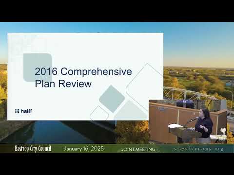
Consultants from Half Associates reviewed the 2016 comprehensive plan and led a joint workshop of the Bastrop City Council and Planning and Zoning Commission on Jan. 16 to update Chapters 2 and 5, the sections that govern growth and future land use.
Consultants from Half Associates reviewed the 2016 comprehensive plan and led a joint workshop of the Bastrop City Council and Planning and Zoning Commission on Jan. 16 to update Chapters 2 and 5, the sections that govern growth and future land use.
The presentation, led by Ilda Capricioso of Half Associates with presenters Whitney Lindner and Melissa Boudre, summarized the 2016 growth scenarios used to shape the existing future land use map and asked council, commissioners and residents to “gut-check” those assumptions in light of roughly eight years of development since the plan was adopted. "We want to learn and share, affirm the vision and goals," Lindner told the group as the consultants described the current public-engagement program.
Why it matters: Chapters on growth and land use form the foundation for other plan elements and for how the city uses the comprehensive plan to inform zoning and infrastructure decisions. Council members and residents repeatedly raised that infrastructure capacity — especially water, wastewater, roads and drainage — has driven where growth actually occurs, not always where the 2016 map indicated it should.
Half Associates reminded the workshop that comprehensive planning in Texas rests on Section 213 of the Texas Local Government Code and that municipalities use the plan as a guiding (not regulatory) document. Capricioso said the 2016 plan emphasized contiguous growth, corridor-oriented development and concentrated infill; staff and many attendees said actual development has frequently followed developer-installed infrastructure, including municipal utility districts (MUDs), which can produce rapid growth in areas not previously prioritized by the plan.
The consultants described five growth scenarios considered in 2016 (scattered, cluster, corridor, contiguous and infill) and noted the city has seen examples of rapid perimeter growth after developers provided water and wastewater infrastructure. "The city doesn't put in the original infrastructure to a development. The developer does, and then they turn around and dedicate that to the city," a staff member said during discussion.
Public engagement and preliminary findings: Half Associates reported roughly 500 total respondents across four weekly online surveys (about 202 respondents on week one). Highlights: 71% of respondents strongly agreed with maintaining long-term water capacity as a goal; 64% strongly agreed with maintaining water quality in the Lower Colorado River watershed; only 31% strongly agreed that the future land use plan is routinely used to guide development decisions. In hazard and heat mitigation questions, respondents prioritized more green spaces (76%) and shade trees (73%) and recognized wildfire (62%) and flooding as significant risks.
Council and commissioners used a SWOT and a mapping exercise to mark areas that are working, where caution is needed and where changes are desired. Recurring concerns included: - Water and wastewater capacity and where the city will extend service - Traffic congestion and the need for additional east–west crossings and improved evacuation options - Flood risk downtown and along tributaries (Gills Branch, Piney Creek) after Atlas 14/FEMA map updates - Wildfire risk at the wildland-urban interface, especially near the state park and newer subdivisions - Housing affordability and the need for diverse housing types (multifamily, senior, small units) and incentives
Several elected officials and residents emphasized the role of infrastructure in shaping growth. Councilmember Kevin Plunkett observed past decisions to deny certain developments had long timelines and consequences on the retail mix today. Multiple speakers urged the plan update to be explicit about the relationship between the comprehensive plan and zoning so that future rezoning aligns with adopted principles.
Hazards and resilience: Melissa Boudre (Half Associates) presented hazard overlays showing areas of high impervious cover, identified flood problem areas and places with wildfire risk using a wildland-urban-interface dataset. Workshop participants and consultants discussed strategies the city can pursue in the comprehensive plan and code updates: prioritize green infrastructure and low-impact development on new parcels; include resiliency hubs or harden existing community facilities with backup power and water supply; coordinate with county, state and utility partners to create redundancy for water, power and transportation; and adopt site-level requirements that reduce runoff and wildfire exposure.
Public comments and next steps: Residents who spoke in the public comment period stressed evacuation planning, tree and landscaping policies, the Colorado River’s recreational potential and affordable housing. The consultants said the city will use workshop feedback to revise goals and prepare a draft future land use map; the team scheduled public open houses in the following two weeks and planned technical-committee, P&Z and council review in spring.
Ending: Half Associates and city staff asked participants to review distributed character-area definitions and maps, noting the next public open houses will be the community’s last scheduled opportunities before a formal P&Z review. The city will incorporate workshop and open-house input into a draft plan and future land use map for subsequent public hearings.