Get Full Government Meeting Transcripts, Videos, & Alerts Forever!
Get email alerts on the Coastal Resilience Vulnerability Assessment topic
No spam. Unsubscribe anytime.
Indian River Shores hears draft coastal vulnerability assessment, looks toward resilience projects
Summary
Consultants presented a draft townwide vulnerability assessment showing limited near-term inland exposure but substantial impacts to shorelines and critical assets under future sea-level rise and storm scenarios; consultants and staff discussed next steps for project prioritization and potential DEP funding.
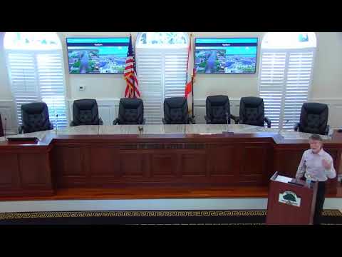
Consultant Steve Bowning, a licensed professional engineer with Coastal Waterways Design and Engineering LLC, told the Town of Indian River Shores that the townwide vulnerability assessment was intended to guide resilience projects and satisfy a state grant requirement.
"The Town of Indian River Shores is conducting a town wide comprehensive vulnerability assessment pursuant to section 380.093, Florida Statutes," Bowning said. He said the draft assessment pairs exposure maps with sensitivity tables and represents the town's last opportunity to submit community-specific feedback before the final report.
The report analyzed 12 scenarios that combined sea-level rise projections, high-tide events, FEMA flood conditions and modeled storm surge. Using NOAA-provided projections for target years and state guidance, the consultants produced maps for intermediate low and high sea-level-rise scenarios for 2040 and 2070 (and noted that DEP is moving to 2050 and 2080 for future updates). Bowning said the analysis showed relatively limited exposure in most developed upland areas under intermediate scenarios but large impacts at shorelines, the Back Bay and in the event of a modeled Category 3 storm surge.
The consultants showed GIS visualizations of the Fred Turk Drive and State Road A1A corridor that illustrated how inundation depth increases with more extreme scenarios. Under a combined high-tide plus intermediate-high 2070 scenario, Bowning cited localized depths reaching about 9 feet at some shoreline hotspots, with half a foot in some driveways and nearly 2 feet in center lanes at specific intersections. A modeled Category 3 storm surge raised those depths further; in the consultant's examples the driveway in front of the public safety building reached about 3.2 feet under a cat‑3 surge.
Bowning distinguished exposure (extent of flooding) from sensitivity (depth and consequence). He summarized the state-prescribed risk thresholds used in the report: for roadways the team classified low risk as roughly 6 inches to 1 foot of water, medium risk as 1 to 2 feet, and high risk as more than 2 feet. For critical facilities the report used under 1 foot as low risk, 1–3 feet as medium, and more than 3 feet as high. For lift stations the presentation noted that water intruding into wet wells can occur even at lower depths and that over roughly 2 feet of water can begin to affect electronics and telemetry.
The assessment identified key assets for focused analysis: State Road A1A, the town's electrical facilities, multiple lift stations, a cell tower, the town's debris-management FEMA lot, the community center and public-safety/town-hall campus, Atlantic shoreline and Indian River Lagoon shorelines, and conservation lands and wetlands. Bowning noted that some north-island roadways were more susceptible in lower scenarios than other parts of town, and that a catastrophic event (cat‑3 on top of intermediate-high 2070 sea-level rise) would flood much of the roadway network in the study area.
The consultants said the report does not model wave-driven erosion or dune breach directly in most scenarios; it models elevated water and, for the 1% (100‑year) storm, runs numerical wave models that produce wave run-up and erosion results. Bowning recommended a follow-up numerical analysis (FEMA WAFIS-style wave- and erosion modeling) on higher sea-level scenarios to test dune breach vulnerability, noting that other communities' analyses have shown dune breaches in comparable scenarios.
Bowning and staff discussed next steps: finalize the report with any comments the town provides now; consider submitting an updated analysis to DEP using more recent projections or alternative numerical modeling; and use the vulnerability assessment to support eligibility for DEP coastal-resilience grant funding. "We actually wanna do something with this document. We don't want it to sit up on the shelf and get dusty," Bowning said.
No formal votes or motions were recorded during the presentation; the meeting proceeded to questions and public/staff discussion after the consultant's remarks.
The draft assessment, GIS maps and supporting tables will be incorporated into the final report; consultants and staff said the town may pursue targeted additional modeling (for dune breach and wave-driven erosion) and potential project applications to the Florida Department of Environmental Protection's coastal-resilience programs.