Johnson County commissioners forward Map 1 in 2025 redistricting process
Summary
After public meetings and online input, Johnson County commissioners voted to forward Draft Map 1 to the full board for consideration July 31, 2025. Commissioners discussed deviations, projected longevity and public comments before the 7-0 procedural vote.
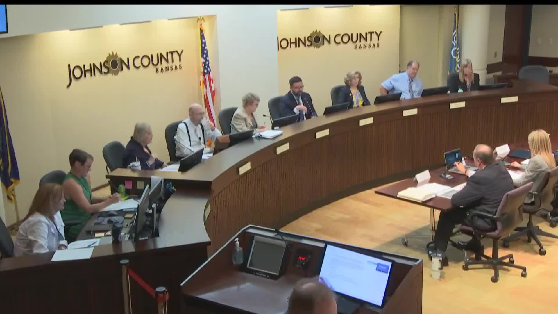
Johnson County commissioners met July 24, 2025, in a committee of the whole and voted to forward Draft Map 1 in the county's 2025 redistricting process to the full Board of County Commissioners for consideration on July 31. The meeting included staff presentations, a consultant review of public engagement and a legal overview of statutory compactness requirements.
The vote follows a month of public outreach in June that the county said included six in-person sessions, a virtual session, a redistricting website and a public mapping tool. Andrew Dressler, the consultant from Haystack DNA, summarized the public inputs and three draft maps that were displayed for comment.
Why it matters: redistricting redraws the county's six commissioner districts and can change which voters are assigned to which district. Commissioners said they weighed competing goals — minimizing how many residents are moved, keeping cities whole when possible, meeting state compactness law and extending the expected life of the map in the face of local growth patterns.
Dressler told the board the outreach included use of Dave's Redistricting App and that the county had a dedicated web page with an online comment form. He reported 83 written comments through the portal and nearly 60 people attended the in-person sessions. “Map 1 had majority support,” Dressler said, “Map 2 was widely opposed, and Map 3 received limited support, mostly as a secondary preference to Map 1.”
Deputy chief director of legal services Cindy Dunham told commissioners the controlling law requires districts to be compact and as equal in population as possible and that, based on Kansas Supreme Court guidance, courts look at natural topography and transportation corridors when interpreting compactness. “To be clear, there’s no concern here that all of these maps do not meet the [statutory] requirements,” Dunham said.
Staff and the consultant reviewed key numeric tradeoffs among the three draft maps: Map 1 was described as producing the smallest overall population deviation (4.39%) and moving “just under 19,000” people between districts, with an estimated life of about five to eight years; Map 2 moved the fewest people (about 13,000) and was presented as having the longest projected life (about eight to ten years) although its overall deviation was larger (about 6.45%); Map 3 moved the most people (about 34,000) and was designed to create more runway for growth in certain districts while accepting larger initial reassignments.
Commissioners pressed staff and the consultant on specific precinct moves, local growth expectations and how those moves affected deviation numbers for individual districts. For example, commissioners asked about a segment described in discussion as moving roughly 2,400 residents from one district to another to help even out Districts 5 and 6; staff told the board that moving that area back would increase the map’s overall deviation to about 6.83% from 4.39%. Commissioners also discussed projections for Districts 3 and 6, which staff said are expected to grow more rapidly and therefore influence the projected lifespan of each map.
Commissioner discussion reflected differing preferences: several commissioners expressed support for Map 1 because it minimizes overall deviation; others said they favored Map 2 or Map 3 because of growth projections and longevity. Commissioner Ashcraft moved to forward Map 1 to the full board for consideration on July 31; Commissioner Myers seconded the motion. The clerk recorded a 7-0 vote in favor (Commissioners Fest, Myers, Brewer, Hanslick, Ashcraft, Allen Brand and Chair Mike Kelly voting aye).
The board’s formal action was procedural: staff were directed to return Map 1 to the full board for consideration and possible adoption on the July 31 agenda. No final adoption of a new legal plan occurred at this committee-of-the-whole meeting.
Next steps: the map will be presented to the full Board of County Commissioners for formal consideration and potential adoption on July 31, 2025. If the board requests additional tweaks, the consultant and staff said they could produce revised maps within the county’s announced timeline for final deliverables.