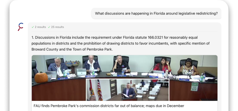
Winchester adopts updated official zoning map; changes effective July 15
Summary
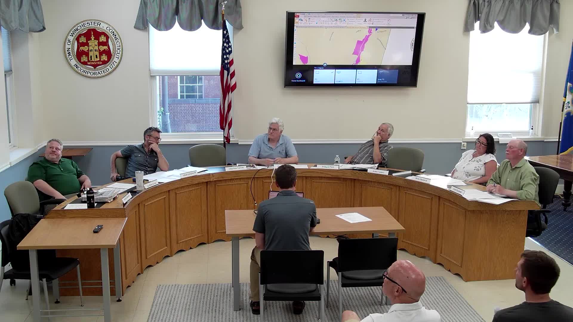
The Planning and Zoning Commission approved an updated official zoning map including North Main Street rezones and corrections to previously‑approved parcels; the commission set the map’s effective date for July 15, 2025, to allow for publication and the appeal period.
The Winchester Planning and Zoning Commission approved an update to the town’s official zoning map on June 23 and set the map’s effective date as July 15, 2025, to permit legal notices and the statutory appeal period to run before the changes take effect.
Staff presented a consolidated spreadsheet of previously approved zone changes and newly proposed map edits; the update includes rezoning portions of North Main Street’s west side to Town Gateway to align lots that are commercial in use, while restoring a few single‑family homes back to a residential category in response to previous discussions. Staff also corrected one parcel on Old New Hartford Road (parcel listed as 208) that had been omitted from an earlier update.
Commissioners reviewed the list and the map on screen, asked staff to confirm previously approved changes that had not been reflected on the map, and directed that direct mailings be sent to affected property addresses as part of the effective‑date process. The motion included standard findings that the updated map is consistent with the town’s plan of conservation and development.
The commission voted to make the map effective July 15, 2025, to allow time for publication and the appeal period. Staff said the map file had not been regularly updated since 2017 in the town’s records and that this consolidated update reflects changes through June 12, 2025.