Get Full Government Meeting Transcripts, Videos, & Alerts Forever!
Walworth County zoning staff demonstrate drone use, detail costs and limits
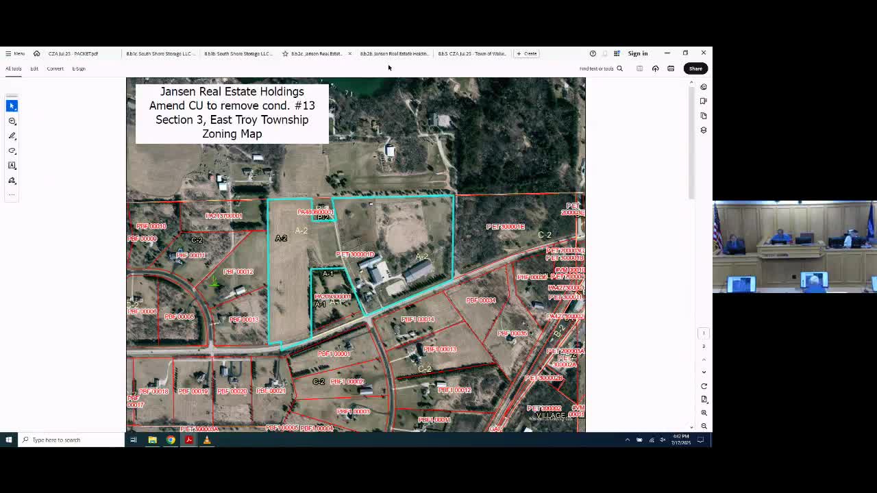
Summary
County zoning staff demonstrated drone capabilities for site overlays, enforcement and public works, and discussed related costs, training, privacy concerns and planned software investments.
Walworth County zoning staff demonstrated a county-owned drone and described how the technology is used for site plan overlays, enforcement checks and public-works surveys, and told the Zoning Agency the county will pursue related software and hardware upgrades.
Staff said the drone is flown by a certified pilot for permitted county work, and showed examples including overlays for proposed solar arrays, gravel pits and a recent Tomala site review. Kate, a Zoning Department staff member, said the visuals help agency members and the public “see what you’re getting” when the county asks for technology funding.
Agency members were given a short video tour and an outdoor demonstration. Chris, the county’s certified drone pilot, described operational limits and precautions: “The transmission distance is, like, 3 miles, but stick within, like, a generally, a 40‑acre field,” he said, adding that pilots should maintain line of sight and often use a spotter. He also…
Already have an account? Log in
Subscribe to keep reading
Unlock the rest of this article — and every article on Citizen Portal.
- Unlimited articles
- AI-powered breakdowns of topics, speakers, decisions, and budgets
- Instant alerts when your location has a new meeting
- Follow topics and more locations
- 1,000 AI Insights / month, plus AI Chat