Get Full Government Meeting Transcripts, Videos, & Alerts Forever!
Get email alerts on the Land Use Rezoning topic
No spam. Unsubscribe anytime.
Douglas County approves vacating Lot 5 and rezones parcel to AG‑1 to allow rebuilding on adjacent level ground
Summary
The Board of Douglas County Commissioners voted 5–0 July 16 to vacate Lot 5 in Twin Ridge Heights West and rezone about 6.42 acres to AG‑1, enabling the property owner to create a buildable parcel on adjoining, less steep land after staff found the original platted lot unsuitable for construction.
Douglas County commissioners voted 5–0 Wednesday to vacate Lot 5, Block 1, Twin Ridge Heights West Subdivision and to rezone an approximately 6.42‑acre area to AG‑1 (Agricultural District) to allow the property owner to combine land and locate a house on a buildable, less steep area.
Mary Miller, city/county planner, told commissioners the two requests are “closely related” and that the owner initially intended to build on the platted lot but discovered “extreme topographical changes” and a ravine that made the lot poorly suited to development. Miller said the owner also owns a larger parcel to the west without road frontage and that vacating the platted lot and rezoning to AG‑1 would permit use of an agricultural subdivision exemption to create a buildable parcel.
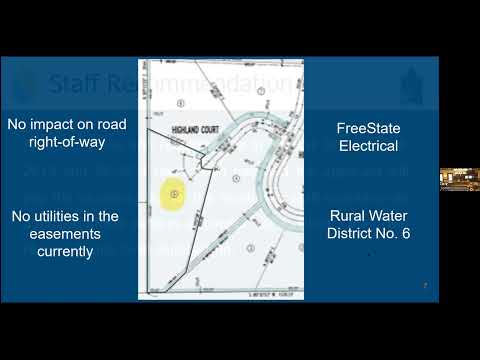
The planning staff reviewed alternative options and concluded the Cluster Preservation (CP) district is closed to new rezoning, so expanding the lot under CP was not available. Miller summarized the statutory steps: the applicant filed the petition to vacate, the hearing was noticed at least 20 days in advance, and the board must find no loss or inconvenience to the public nor injury to private rights before ordering the vacation. Service providers contacted — Freestate Electrical and Rural Water District No. 6 — reported no objections and described how service lines would be extended from existing rights of way.
Commissioners cited the site’s steep topography, woodland cover and the location of a more level clearing immediately west of the platted lot in supporting the request. Miller told the commission the request aligns with the comprehensive plan’s environmental and rural‑character chapters because the proposed approach reduces grading and conserves identified steep‑slope sensitive lands while maintaining an opportunity for a single house rather than increasing density.
At the public hearing on the vacation petition no members of the public spoke. A commissioner moved to approve the vacation, including preserving the cul‑de‑sac dedication for public use, and to adopt Resolution No. 25‑28; the motion was seconded and passed 5–0. The board then separately approved the rezoning request (Z‑25‑0006) from the Cluster Preservation district to AG‑1 and adopted Resolution No. 25‑209 by the same 5–0 vote.
The planning staff noted the original platting occurred in 1988 and that the peripheral easements on the platted lot were intended for future urban utilities; staff does not expect annexation in the foreseeable horizon of the county comprehensive plan. The applicant will pay recording costs for the resolution vacating the platted lot, and utility connections will require extensions from mains in the adjacent rights of way.
Commissioners directed staff to record the board’s orders with the register of deeds as required by statute and to proceed with the rezoning ordinance paperwork. No further enforcement actions or conditions beyond those in the adopted resolutions were stated at the meeting.
The county moves next to other agenda items; the vacated parcel and rezoning will be reflected in county records after the required recording steps are completed.