Get Full Government Meeting Transcripts, Videos, & Alerts Forever!
Get email alerts on the Flood Maps And Insurance topic
No spam. Unsubscribe anytime.
Updated FEMA flood maps expand high-risk area in Ithaca; county and insurers outline options for homeowners
Summary
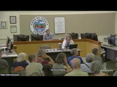
City and county staff and a local insurance agent warned residents that new FEMA flood maps — effective June 18 — placed hundreds more properties into the special flood hazard area. Officials described mitigation work under design and explained insurance options, including the National Flood Insurance Program and private flood policies.
City and county staff and a local insurance agent briefed residents on new Federal Emergency Management Agency (FEMA) flood maps and insurance options, telling attendees that the map updates will expand high-risk designations and could require some homeowners with federally backed mortgages to buy flood insurance.
"Just in the city alone, we had 600 additional properties mapped into the special flood hazard area," said Lisa Nicholas during the session, summarizing the scale of the change for City of Ithaca residents. Sam Quinn Jacobs, a city planner, walked through how to read FEMA’s Flood Insurance Rate Maps and where property owners can access them online.
The new maps — speakers said they became effective June 18 — use more detailed inputs (including LIDAR and building elevation data) and adopt FEMA’s Risk Rating 2.0 approach, which calculates premiums at a more granular, property-specific level. Abigail O'Connor, environmental planner at the Tompkins County Department of Planning and Sustainability, described a county web page of resources, videos and forms intended to help residents, real estate agents and insurers navigate the change.
Why it matters: Properties newly mapped into the special flood hazard area (also called Zone AE, the 1% annual-chance floodplain) typically trigger mortgage-related insurance requirements for loans from federally backed lenders. Val, vice president at Bailey Place Insurance, said, "Once you get that letter, you have 45 days to get a policy in place." If owners do not secure a policy within that period, lenders can impose a government-mandated, lender-placed policy.
Speakers urged residents to consider options early: FEMA’s National Flood Insurance Program (NFIP) remains available in participating communities; private-market flood insurers also offer alternatives, sometimes with different limits, waiting periods and underwriting rules. Val showed example quotes for a single property where the NFIP premium was $3,808 for specified building coverage while two private quotes for the same limits were $1,581 and $1,354, illustrating how premiums can vary by insurer and property specifics. Elevation certificates and other mitigation measures (raising utilities, installing flood vents, or elevating structures) can change a property’s premium or eligibility.
City mitigation work and FEMA modeling: City staff described a federally funded flood mitigation project now in design that includes bank and wall elevation, dredging and backflow prevention around Fall Creek. City staff said consultants identified conservative assumptions in FEMA’s hydraulic modeling that reduce the designed project’s effectiveness; the city is preparing a submission to FEMA to revise those modeling assumptions. As city staff explained, "we're actually submitting 1 to FEMA. A letter of map amendment. We're not challenging boundaries of the map, but we're challenging some of the assumptions that were made," and staff said resolving that issue is necessary to preserve funding and ensure the project performs as intended.
Practical details and common questions: presenters described common features of flood insurance: NFIP building coverage limits, typical exclusions, and practical differences with private flood policies. Speakers said NFIP residential maximum required by lenders is generally $250,000 (commercial $500,000) and that NFIP and private policies are annual and typically payable in full at purchase or renewal. Abigail emphasized county resources including videos on how to read maps and on the Letter of Map Amendment (LOMA/LOMR) application process; Val noted elevation certificates can cost roughly $300–$2,000 and sometimes lead FEMA to remove properties from the high-risk zone.
Throughout the meeting residents raised local drainage concerns (sediment build-up at the Fall Creek inlet, new fill behind a commercial area near Walmart, and basement groundwater issues). County staff referred residents with drainage or site-specific problems to the Tompkins County Soil and Water Conservation District and to municipal planning or code enforcement for permit and engineering questions.
No formal votes or regulatory decisions were made at the session. Presenters and staff repeatedly directed homeowners to the county and city online resources, invited elevation determinations and insurance quotes, and said the city will press FEMA on modeling assumptions before construction of mitigation projects can proceed.
Ending: County and city presenters said they will continue updating online resources and outreach as FEMA responses and project design work proceed. "If you want a flood zone determination or an elevation certificate, please feel free to call us," Val said, summing up the immediate next steps for property owners seeking clarity.