Athens planning commission reviews steering committee's proposed 2045 future land use map
Get AI-powered insights, summaries, and transcripts
Subscribe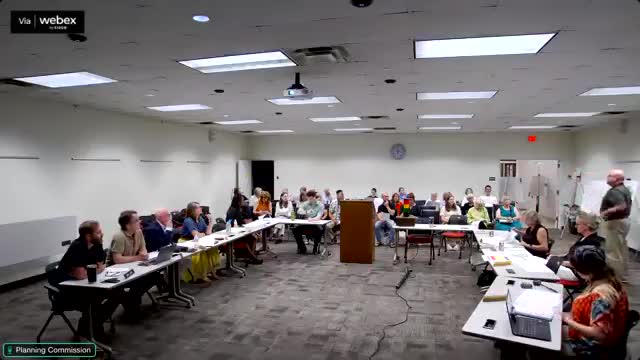
Summary
A steering committee appointed by the mayor presented a proposed 2045 future land use map at an Athens-Clarke County Planning Commission work session, concentrating the county's primary redevelopment capacity in roughly 5.6% of the county and adding new corridor and node categories to guide where denser housing and mixed-use activity could be encouraged over the next 20 years.
A steering committee appointed by the mayor presented a proposed 2045 future land use map on the record at an Athens-Clarke County Planning Commission work session, recommending a policy framework that concentrates the heaviest new growth on roughly 5.6% of county land and adds new categories to guide redevelopment along corridors and at neighborhood, town and urban centers.
The committee's work, which the steering committee chair said followed 14 months of meetings and two rounds of public input, produced a revised map and a package of new land-use categories planners say are intended to translate community priorities into a policy document that the mayor and commission can use when considering future zoning changes.
Why it matters: The future land use map is not zoning, staff and committee members repeatedly said, but it sets a policy expectation that can unlock where denser development, mixed use and infrastructure investment are likely to be encouraged. That matters because commissioners and staff use the map to evaluate requests to change zoning and to target capital investments in sewer, roads and parks.
Steering committee chair Alex Sams told commissioners the map represents the committee's work, not staff's. "This is not staff's map. ... If you don't like the map, it starts with me," Sams said, repeatedly emphasizing that the committee aimed to reflect community input collected during 2023 and 2025 engagement events.
Mark Pichuk, a planning staff presenter, opened the technical explanation with a basic distinction: "What a future land use map is ... it is not a zoning map." He said the map is meant to be a 20-year policy guide and that Athens-Clarke County's local process allows revisiting the map sooner than a once-in-a-decade cycle if needed.
What the proposal contains
- Categories and scale: The steering committee translated the county's prior nine future-land-use categories into 16 refined categories and layered a growth-concept map of corridors and nodes. Downtown, urban centers, town centers, neighborhood centers, major and minor corridors, and several residential and rural categories are among the new labels.
- Geographic focus and capacity: Staff said county population projections and recent growth patterns indicate roughly 30,000 additional residents by 2045. To accommodate that growth with fewer changes to the county's full land area, the plan concentrates most of the capacity in about 5.56% of the county, while encouraging smaller-scale increments of change across sewer-served neighborhoods.
- Design and form: The plan emphasizes human-scaled design in many in-town nodes (2'3 stories commonly described as "human scale"), shared parking in business districts, reduced surface parking in favor of on-street or structured options where appropriate, tree preservation, neighborhood open space and multimodal connections along corridors and the Greenway/Firefly Trail.
Public input and committee process
Steering committee members described extensive public outreach: staff-led engagement in fall 2023, neighborhood walks, two bus tours of east and west sides, about 26 public events during the initial phase, and additional spring 2025 input including about 700 visual-preference comments and more than 2,000 survey responses over the two-round process, according to staff summaries presented at the meeting. The committee said it met monthly and sometimes more often across the 14-month period.
Areas flagged for attention
Commissioners and public speakers raised questions about specific edges and transitions where new corridor or node designations abut established residential streets. Commissioners asked staff to provide close-up map blowups for specific local concerns before a planned commission vote.
Public commenters pressed several recurring concerns: traffic and parking in 5 Points, potential displacement and the neighborhood impacts of increased density, setbacks and tree preservation, and how the map intersects with student housing patterns.
Rita Kelly, a 5 Points resident, said she was "very disappointed" with a committee recommendation that would allow denser rules for a Pine Crest block and warned it could raise parking problems and attract higher-priced development rather than housing affordable to long-term residents.
Ken Portier, speaking as a resident, urged clearer, more actionable legend language: "The map is useless without the legend and the legend titles are useless without description," he said, calling the document both a policy and a vision tool.
Staff and committee replies
Staff repeatedly reminded the public that a future land use map is a policy document, not zoning, and that setbacks, parking requirements and other development rules are determined by the zoning code. Mark Pichuk said the map's job is to "set the table" for zoning changes and capital investment, not to implement those rules directly.
Several commissioners and committee members noted that the map also aims to help secure grant funding and coordinate capital projects by signaling where the county expects growth and where infrastructure investment (for sewer, roads and transit) would be prioritized.
Next steps
Commissioners discussed whether to schedule a formal recommendation vote at the commission's August 7 meeting. Several members said they expect to be ready at that date but asked staff to provide detailed, zoomed-in map views of a few contested areas (for example, parts of 5 Points and Hawthorne Extension) so commissioners and residents can see parcel-level effects.
There were no formal motions or votes at the work session. Staff and committee members said they will publish the steering committee report and supporting materials, and that the planning commission will consider whether to forward a recommendation to the mayor and commission at the August meeting.
Ending
The steering committee and planning staff said a final public-report packet with the map, the report of community input and technical appendices would be published before the next decision step. Commissioners said they want clearer zoomed-in maps and a short written summary tying the categories to the kinds of zoning or implementation actions the county might later take, while reiterating that any future rezoning must itself follow separate public processes with additional hearings.