Lifetime Citizen Portal Access — AI Briefings, Alerts & Unlimited Follows
Miami Beach staff revise Normandy Isle traffic‑calming plan to cut parking losses, seek property owner concurrence
Loading...
Summary
City transportation staff presented redesigned traffic‑calming devices for Normandy Isle that reduce projected on‑street parking loss from 66 to 27 spaces, while noting two proposed traffic circles remain opposed by adjacent property owners and some measures require county or FDOT approval.
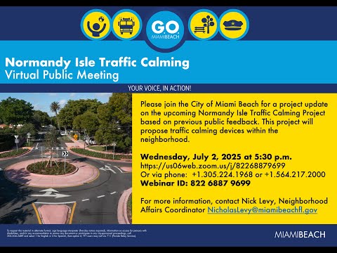
City of Miami Beach transportation staff on a public Zoom meeting presented revised plans for the Normandy Isle Geo Bond traffic‑calming project and said the redesign reduces projected parking losses from 66 to 27 spaces while keeping most of the originally planned traffic‑calming devices.
The meeting on the Normandy Isle project was led by O'Neil Rodriguez, assistant director of the Transportation and Mobility Department, who said the team “heard your concerns” and “redesigned a lot of the devices to minimize as much as possible the impact to on street parking.” The update summarized device changes, parking impacts, coordination with Florida Department of Transportation projects on 70th Street/Normandy Drive, and next steps for property‑owner outreach and county approvals.
Why it matters: Normandy Isle residents and condo representatives raised questions about lost parking, emergency access, drainage and the effectiveness of roundabouts, humps and cushions. The project uses voter‑approved Geo Bond funding and requires county and, for some corridors, FDOT approval; several measures therefore remain contingent on outside agency signoff and owner concurrence.
Staff described the design process, device selection and recent changes. Ghassan Shway, the city's senior transportation engineer, said the team replaced some previously proposed traffic circles and raised crosswalks with smaller devices where possible (speed tables, speed cushions and speed humps) to save parking. “We had a total of 66 parking loss. Now with the current design, we lowered it … to 27 parking spots,” Shway said, adding the changes saved about 39 on‑street spaces.
Design changes and devices described by staff include: - Removed traffic circles at Bay Drive & Brestes Planard and at Bay Drive & Marseille Drive because of parking impacts. - Removed several raised crosswalks after they were not approved by the county (locations listed by staff included Marseille Drive, Rue Notre Dame and Bieritz Drive). - Added two traffic circles (one at Trouville Esplanade & Biarritz and one at Calais Drive/Rue Bordeaux & Marseille Drive). - Added speed cushions on Bay Drive (between Rouversaile Drive and Rue Notre Dame) and additional cushions/humps on Bay Drive and between Normandy Drive and Marseille Drive; several speed humps and narrowing segments remain in the plan.
Staff said some devices adjacent to private properties require 100% approval from directly impacted property owners under the city's traffic‑calming manual. O'Neil Rodriguez explained that where a traffic circle touches four properties, staff must obtain concurrence from all four corners; if staff cannot obtain unanimous support they will either continue outreach or present the device at a city commission public hearing for a final decision.
Residents and building representatives raised several recurring concerns during the Q&A: potential loss of parking in front of condo buildings, fire‑rescue vehicle access through traffic circles, possible increased flooding from raised elements, and whether the measures would actually slow drivers who currently run stop signs. Staff responded that the roundabout design is mountable for large vehicles and that drainage and sight‑distance requirements would be addressed in the final engineering. Ghassan said sight‑distance and approach clearance standards sometimes require removing parking near devices to maintain safe visibility for drivers and pedestrians.
Coordination with FDOT and county agencies was a central theme. Staff said FDOT is leading separate but related work on 70th Street and Normandy Drive — a state road — including resurfacing, ADA curb ramp upgrades, crosswalk improvements with flashing beacons, no‑turn‑on‑red changes and signal equipment upgrades. Because Normandy Drive and 70th Street are arterial/causeway routes used for evacuation, staff said FDOT will not permit speed humps or similar physical impediments on those corridors but will pursue signage and other speed‑management measures.
Staff also summarized schedule and outreach: finalize design by fall 2025, begin construction in spring 2026 and aim to complete work by fall 2026. Nicholas Levy was named as a local point of contact for North Beach outreach. Staff said the full plan set will be shared with residents and that they will follow up one‑on‑one with property owners who have expressed opposition.
Ending: Staff closed by thanking participants and encouraging residents with specific concerns about driveway impacts, precise parking locations or requests for one‑on‑one meetings to contact the project team for maps and meetings. The city reiterated that several measures remain contingent on county or FDOT approvals and on property‑owner concurrence for devices adjacent to private property.