Get Full Government Meeting Transcripts, Videos, & Alerts Forever!
Get email alerts on the Land Use Zoning topic
No spam. Unsubscribe anytime.
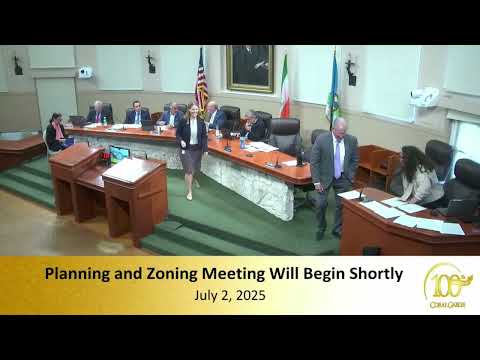
Coral Gables planning board backs city overlay to limit county rapid-transit rules near University Station
Summary
The Coral Gables Planning and Zoning Board voted 5–1 on July 2 to recommend a city zoning overlay and comprehensive‑plan changes that would create a University Station Rapid Transit District overlay for four parcels near the University Station Metrorail stop, limiting building massing and requiring rear stepbacks and landscaping to reduce impacts on adjacent residential areas.
The Coral Gables Planning and Zoning Board voted 5–1 on July 2 to recommend that the City Commission adopt a comprehensive-plan amendment and a zoning-overlay creating a University Station Rapid-transit District for four properties near the University Station Metrorail stop.
The measure, presented by Jennifer Garcia, Planning and Zoning Director, would change the city future land-use designation on targeted parcels from commercial low-rise intensity (MX‑1) to commercial high-rise (MX‑3) for the properties bounded by South Dixie (US‑1), Caballero Boulevard, Madruga Avenue and Turin Street, add an overlay to the comprehensive plan and amend zoning text to create a University Station Rapid Transit District in city code.
The board’s recommendation limits the changes to a narrowly defined footprint, preserves a 20‑foot setback along US‑1, adds a 25‑foot landscape buffer at the rear of the deeper lots, sets a maximum base height of 120 feet in the overlay (with additional limited bonus height provisions described in staff materials), retains a maximum density of 125 units per acre, and proposes a two-tier stepback (a standard 10‑foot setback above 45 feet and an additional stepback at higher elevations on the rear of the lots so massing faces US‑1 rather than the adjacent residential blocks). Garcia said the city’s draft would not increase FAR beyond the zoning district’s governing limits and that the overlay was prepared in direct response to Miami‑Dade County’s Rapid Transit Zone (RTZ) regulations.
Why it matters: County RTZ rules already established a process allowing properties near Metrorail nodes to seek expedited review and different development standards; Coral Gables leaders said adopting their own overlay would keep zoning decisions and compatibility controls at the municipal level for these parcels instead of ceding jurisdiction to the county. County Commissioner Raquel Regalado, who appeared at the meeting, told the board the RTZ was intended to concentrate housing and services near transit nodes and described the county’s broader transit investments and connectivity efforts.
Board and public debate focused on scale, traffic and emergency response. Dozens of residents who live within a few blocks of US‑1 told the board they feared the proposed changes would bring taller buildings, more cars and loading activity to narrow neighborhood streets. Multiple commenters asked the city to study or improve the Caballero/US‑1 intersection and raised life‑safety concerns for emergency responders behind the corridor. Several speakers urged protections for the City Beautiful character of Coral Gables and questioned whether students and other future occupants would actually use transit rather than cars.
What the city proposed and what the county proposed: Staff said current MX‑1 parcels are subject to a 45‑foot height limit; MX‑3 zones allow up to about 150 feet. The county RTZ language had proposed a 150‑foot allowance near the station; the city’s overlay proposes a lower 120‑foot baseline and specific stepbacks and landscaping requirements intended to reduce the visual and traffic impact on adjacent residential blocks. Staff also presented parking differences: county RTZ language can allow minimal residential parking, while the city draft requires parking for residential uses but proposes reduced parking requirements (for example, a 50% reduction in required spaces under some conditions and a 25% waiver if the applicant produces a parking‑management plan or provides transit passes).
Votes at a glance: F‑1 (Comprehensive plan map/text amendment to add University Station overlay for specified blocks) — Motion to approve carried (roll-call: Felix Pardo yes; Robert Behar yes; Alex Bussello yes; Sue Kamalinski no; Nestor Menendez yes; David Eisenstadt yes) — outcome: recommended for approval to the City Commission. F‑2 (Zoning text and map amendments to create University Station Rapid Transit District overlay and adjust MX‑1 to MX‑3 at specified parcels) — Motion to approve with an amendment to require additional rear stepbacks (massing to face US‑1; additional stepback at higher elevations on parcel rear) carried on roll‑call (same majority) and was recommended to the City Commission. Both items were publicly noticed and heard at the meeting; staff said the City hoped to bring the ordinances to the City Commission for first reading in August.
What remains unsettled: Several residents asked the city to request near‑term engineering work at the Caballero/US‑1 intersection and to quantify modal shift (how many new residents actually use Metrorail or local trolleys vs. driving). Commissioner Regalado said she would work with the city manager and county transportation staff on intersection and connectivity issues. Staff confirmed the parcels’ owners may still choose to pursue Miami‑Dade RTZ jurisdiction or “live‑local” options; the city overlay is an alternate path intended to keep conditional approvals subject to city standards.
Context and next steps: Jennifer Garcia said the draft overlay was the city’s response to Miami‑Dade County’s RTZ action and that notices were mailed to properties within 1,500 feet as required by code. Staff recommended approval in its report. The county RTZ application that prompted the city response had already advanced to the county’s first reading and committee schedule; staff and the county commissioner urged residents to use the county’s public hearing process as well if they wished to be heard on the county application. The planning board voted to defer remaining unrelated agenda items to the board’s next meeting and forwarded the overlay and comp‑plan items to the City Commission for further action and possible amendment.
Ending: The Planning and Zoning Board took the city’s overlay proposal as a protective measure designed to keep control of zoning locally; it recommended the City Commission adopt the proposed comprehensive‑plan and zoning text amendments with the board’s added stepback language and encouraged staff, the county commissioner and the city manager to study traffic and intersection engineering near Caballero and US‑1 before final action by the Commission.