Get Full Government Meeting Transcripts, Videos, & Alerts Forever!
Weber County planners, developer and commissioners discuss open‑space mapping and potential DWR easement for Westbridge Meadows
Summary
County staff and developer representatives outlined open‑space mapping, park ownership and potential state purchase of a 300‑foot buffer along the Great Salt Lake shoreline for the Westbridge Meadows project; commissioners asked for a development agreement provision to allow time for state negotiations and private matching funds.
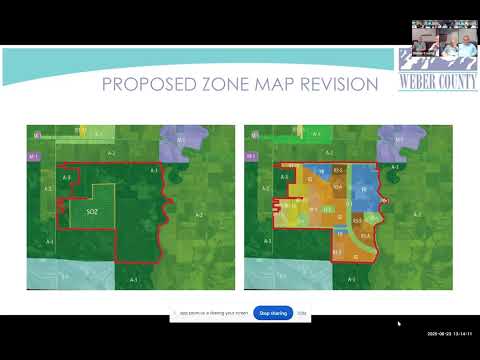
County planning staff and the project applicant discussed how open space, future transportation corridors and parkland would be handled in the proposed Westbridge Meadows master plan during a Weber County Commission work session on June 23.
The county’s presentation showed the zoning map colors that mark master‑planned open space and described the minimum open‑space requirement the applicant must meet: “10 acres per 1,000 population,” county staff said. That standard translates to about 10 acres for every 333 dwelling units, staff added.
Why it matters: Commissioners said they want a larger buffer along the Great Salt Lake shoreline than the applicant has proposed and asked for a mechanism in the development agreement to allow the Utah Division of Wildlife Resources (DWR) time to try to acquire additional land for conservation. Commissioner comments emphasized avoiding condemnations and ensuring property owners are made whole if the state purchases easements or fee…
Already have an account? Log in
Subscribe to keep reading
Unlock the rest of this article — and every article on Citizen Portal.
- Unlimited articles
- AI-powered breakdowns of topics, speakers, decisions, and budgets
- Instant alerts when your location has a new meeting
- Follow topics and more locations
- 1,000 AI Insights / month, plus AI Chat