Get Full Government Meeting Transcripts, Videos, & Alerts Forever!
Get email alerts on the Missoula History Surveying topic
No spam. Unsubscribe anytime.
Surveyor-historian traces how land claims, railroad and maps shaped Missoula
Summary
At a public presentation, Bill Weichel—who said he is known as "Montana Bill"—reviewed how 19th-century land claims, the Homestead Act, GLO surveys and the arrival of the railroad determined Missoula's early plats, cemeteries, water ditches and industrial sites.
Bill Weichel, a Missoula surveyor and local historian, gave an illustrated public talk describing how land claims, federal settlement laws and the coming of the railroad shaped Missoula’s 19th‑century development.
"As she says in the surveying history world ... I'm Montana Bill because I am the 1 of the few people in the Western United States that actively is involved in surveying history," Weichel said during the presentation.
He told listeners that federal laws and surveys drove much of the town’s early pattern. The 1862 Homestead Act, which allowed settlers to claim 160 acres after five years of residence and improvements, and the 1862 Pacific Railroad Act that incentivized rail construction, both figured prominently in his account. Weichel said the General Land Office (GLO) surveys reached the Missoula area around 1870, after earlier “declarations of occupancy” and local filings had already been made by traders and early residents.
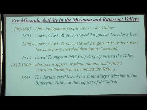
Weichel traced the sequence from early trading posts to mills and town plats: Frank Wharton and Christopher Higgins established a trading post and mills near the Clark Fork in the 1860s; they and other early claimants such as W.J. McCormick, Cyrus McQuirk, David Patty and Frank Warden filed declarations and later obtained patents when surveys were completed. He said some early claimants used irregular occupancy filings to hold land in the path of the expected railroad.
He described how the Northern Pacific reconnaissance survey visited the valley in 1869 and how railroad construction that began in 1870 stalled after the financial panic of 1873, delaying full development. When railroad interests negotiated local plats, Weichel said, some property owners traded lots to the railroad—he described an agreement that involved roughly 500 lots being offered to the railroad for a freight and passenger depot and shops.
Weichel explained the practical choices behind site locations: Missoula Mills sat on an inside river bend that reduced erosion and allowed a mill ditch from the Rattlesnake to be used to power a gristmill. He described early water systems and ditches (including a ditch he said later became called the Hughes or Fredline Ditch), wooden pipe distribution, and the importance of access to water for both mills and town lots.
On burial grounds, Weichel recounted the history and later controversies around the early Cherry Street burial ground and subsequent reinterments. He said the Sisters of Charity established a Saint Mary’s Cemetery in 1873 and that other private burial grounds were later moved or absorbed into the city cemetery.
Weichel showed Sanborn Company perspectives and insurance maps from the 1880s and 1890s and used them to illustrate building materials, identified Chinese‑occupied buildings on the maps, and noted documented “female boarding” (listed in the maps’ terminology). He pointed out the map evidence for roundhouses, depots and early industrial footprints, and noted that the railroad‑drawn subdivisions used the track centerline and railroad stationing as primary survey control.
He also described local subdivision practice in the 1870s and 1880s: lot sizes that differed from modern parcels, varying monumentation requirements as survey law evolved, and the pattern of alleys and block layouts that remain visible in parts of town. Weichel said Parker’s Island and Jacob’s Island resulted from sloughs and man‑made channels and showed how they were built up in later decades.
Audience members asked about specific features such as East Pine Boulevard, local ditches, and the functions of roundhouses. Weichel and other attendees named local participants in the research and field visits (including Ron Milam, Tom Bauer and Dennis Sain) and referenced recent Sanborn maps and local newspaper reporting as sources he used for the presentation.
Weichel told the audience he continues to refine the research and expects future presentations—he singled out Cherry Street Cemetery as material he will investigate further and asked collaborators to help document reinterments and title history.