Get Full Government Meeting Transcripts, Videos, & Alerts Forever!
Get email alerts on the Comprehensive Plan topic
No spam. Unsubscribe anytime.
Kerrville planning commission recommends 2050 comprehensive plan update to City Council
Summary
After a presentation by Freese and Nichols, the Planning & Zoning Commission voted to recommend the City of Kerrville’s 2050 comprehensive plan update to City Council; the draft updates land use, housing, transportation, resilience and two small-area plans for Nimitz Lake and downtown.
The Planning & Zoning Commission voted to recommend the City of Kerrville’s 2050 comprehensive plan update to the City Council after a presentation from a consulting team led by Freese and Nichols.
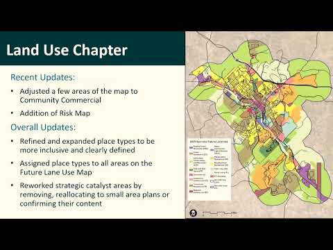
The recommendation follows roughly 12 months of work that updated the city’s land use map, added resilience analysis across topical chapters, refreshed housing and market data and produced two small-area plans for Nimitz Lake and downtown, the consultant said.
Caitlin, a consultant with Freese and Nichols, summarized the update as “a 400 plus page document” and told the commission the project remained on the original 12-month schedule. The update revises place types on the future land use map, assigns preliminary land-use types to previously undefined catalyst areas, and includes a resilience dashboard that highlights flood risk as the most mappable hazard for Kerrville.
On housing, Caitlin presented the plan’s demand estimate of roughly 2,000 to 2,500 housing units; about 1,400 of those are expected to be for-sale units and about 725 for rent. She also said there are about 800 to 900 new single-family homes already in various stages of development, which the consultant said would satisfy the next two to three years of demand in the absence of additional approvals. Caitlin said 36% of homeowners are cost-burdened, the rate for renters rises to 48%, and about 25% of renters are extremely cost-burdened.
The transportation chapter updates the thoroughfare plan and functional classifications. Specific changes called out in the presentation include treating West Main Street as a local road while retaining a portion as a minor collector, and extending Olympic Drive as a major collector to East Main. The plan’s risk mapping overlays floodplain with key thoroughfares to show where flooding could affect the network.
The Nimitz Lake small-area plan emphasizes activating the riverfront while protecting riparian buffers and water quality. The consultant said the south bank contains more floodplain and utility constraints, which the plan suggests are better suited to parks and large-lot residential uses, while the north bank offers more opportunity for mixed-use and local commercial development. The downtown plan recommends targeted investments to expand the core west of Sidney Baker, improve multimodal safety and connectivity, identify catalyst infill and riverfront opportunities, and add parks, plazas and boardwalk concepts.
The consultant showed illustrative renderings intended to help visualize activation scenarios, including a temporary pedestrianized festival at the Water and Earl Garrett intersection and a conceptual boardwalk to strengthen connections between downtown businesses and the riverfront. The draft also includes an implementation matrix with items marked complete or in progress and new recommended actions, such as exploring a Main Street staff position and studying an arts-oriented development requirement for downtown projects.
Drew, a city staff member, noted the plan would be considered by City Council the same evening. After discussion, the commission moved to recommend the update; members signaled support by raising hands and the motion passed. The commission did not record a roll-call vote in the meeting transcript provided.
The recommendation sends the updated plan to City Council for final consideration and any next steps the council may set for adoption, small-area plan refinement, or implementation.