Get Full Government Meeting Transcripts, Videos, & Alerts Forever!
Get email alerts on the Trails And Active Transportation topic
No spam. Unsubscribe anytime.
Heartland Trail study outlines Moorhead-to-Buffalo River route, flags DNR master-plan limits
Summary
SRF Consulting and Metro COG presented a draft Heartland Trail alignment that would begin in Moorhead and extend east toward Buffalo River State Park; public feedback favored non‑highway alignments and councilmembers urged exploring a downtown trailhead connection despite DNR master‑plan constraints.
Mayor Shelley Carlson and council members heard a presentation June 9 on the draft Heartland Trail study that maps a preferred alignment from Centennial Park in Moorhead east toward Buffalo River State Park and beyond.
Stuart Crosby, a landscape architect with SRF Consulting, said the Heartland Trail “is a state trail. It's currently almost 50 miles long,” and outlined a recommended route that starts in Centennial Park, connects to Moorhead’s trail system and follows the Twelfth Avenue corridor east toward Buffalo River State Park.
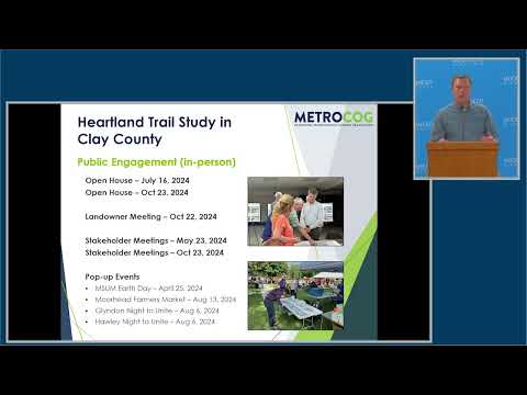
The study, led by Metro COG (the Metropolitan Council of Governments) with SRF, began in January 2024 and included public open houses, a landowner meeting, stakeholder workshops and online engagement. Dan Farnsworth of Metro COG said the team had “a lot of turnout on online engagement” and that 354 contributions were recorded on the study website’s interactive map.
Why it matters: the alignment seeks to extend a long‑standing state trail into Moorhead, creating a regional recreational and transportation corridor. Council members emphasized potential economic and connectivity benefits if the trail ties into Moorhead’s downtown and existing park and trail network.
Key study findings and constraints
• Preferred alignment and trailhead: SRF’s recommended route begins at Centennial Park on 15th Avenue in Moorhead, which the presenters said offers parking and trailhead amenities such as kiosks, seating and bike racks. The blue‑line recommended alignment then heads south through Dilworth and east on Twelfth Avenue toward Buffalo River State Park.
• Public preferences: The study team reported that residents opposed a Highway 10 alignment because it felt too close to traffic and lacked the “outdoors, relaxing, nature type of a feel” commenters sought. The public favored routes described as “rivers and forests” along Twelfth Avenue.
• DNR master‑plan boundary: Crosby cautioned the council that much of the corridor must remain within the Minnesota Department of Natural Resources (DNR) master‑plan area to be designated a state trail. “We really have to stay within that DNR master plan area because if we get out of that ... the DNR has to go back and amend their master plan process, which takes a long time,” he said.
• Phasing and costs: The team proposed a phased build‑out (six phases across the corridor) and estimated trail construction costs ranging from about $750,000 to over $1 million per mile, meaning the full corridor would require multiple millions of dollars and years to complete.
Council reaction and downtown trailhead discussion
Council member Deb White said she was “disappointed that there wasn't any mention of the idea of having the trailhead in Downtown Moorhead,” arguing a downtown trailhead could increase access to restaurants and businesses and attract users. Farnsworth and Crosby said the downtown idea was raised late in the process and would require additional public vetting and, if it fell outside the DNR buffer, a DNR master‑plan amendment.
Council member Heather Niesemeyer and others also urged planners to consider public‑transportation access, continued connections into the city, and opportunities to coordinate trail construction with roadway projects.
Next steps
Metro COG and SRF said they will finalize the draft study after presentations to corridor jurisdictions and aim to bring the plan to their policy board for approval in August 2025. The presenters recommended forming a task force to determine lead entities for implementation and to decide whether sections will be designated as state trail, regional trail, local trail, or a combination — a choice that affects funding and timeline.
Proponents stressed landowner outreach, right‑of‑way review, environmental review and funding pursuit as prerequisites to construction. Crosby said several interim alignments could be used while longer‑term crossings (including a possible grade‑separated crossing of a BNSF rail line in Dilworth) are developed.