Get Full Government Meeting Transcripts, Videos, & Alerts Forever!
Get email alerts on the Transportation topic
No spam. Unsubscribe anytime.
Committee endorses Alternative A2 for South Highway 52 (East Wausau Avenue) design; lighting and sidewalk choices deferred
Summary
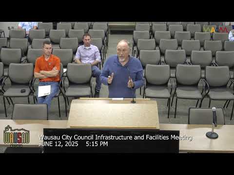
The City of Wausau Infrastructure and Facilities Committee voted 5-0 on June 12 to recommend Alternative A2 as the city’s preferred design for State Highway 52 (East Wausau Avenue) between North Sixth Street and North Eighteenth Street.
The City of Wausau Infrastructure and Facilities Committee voted 5-0 on June 12 to recommend Alternative A2 as the city’s preferred design for State Highway 52 (East Wausau Avenue) between North Sixth Street and North Eighteenth Street.
Committee members backed A2 after staff and the Wisconsin Department of Transportation presented crash data and multiple design options. Stephanie Christiansen, an EMCS consultant working for the Wisconsin DOT, said the corridor showed a persistent pattern of rear‑end crashes in the segment between North Sixth and North Thirteenth streets: "we're really seeing similar type crash patterns, for rear end crashes, specifically in that segment." The project is scheduled for reconstruction in 2029, with DOT leading design and programming.
Why it matters: The stretch carries school traffic and local trips and has a documented crash pattern. The committee’s recommendation will be forwarded to the DOT as the city’s preferred alternative during environmental and 30% plan development.
What the committee heard and decided - Crash review and funding: In scoping, a five‑year crash review (2017–2021) identified 41 crashes in the corridor; roughly half were rear‑end collisions and about 37% were angle collisions, concentrated between Sixth and Thirteenth streets. Staff said roughly 40% of drivers involved were under age 25 and many crashes occurred during school arrival and dismissal times. The project qualified for safety funding to address those issues. - Alternatives evaluated: Consultant Stephanie Christiansen outlined multiple typical sections: Alternative A (center two‑way left turn lane throughout), with A1 (12‑ft travel lanes / 13‑ft median) and A2 (11‑ft travel lanes / 12‑ft center turn lane) variants; B (maintain similar typical section to today); C (public‑driven hybrid options); and D (pavement‑only replacement). A was described as the choice that best addresses the crash pattern; A2 was presented as a compromise that reduces footprint and right‑of‑way impacts. - Committee action: The committee’s staff recommendation was for Alternative A2. Alder Roger Larson (Alder Larson) and other committee members expressed support for A2 as a safety‑focused compromise; Alder David Watson (Alder Watson) made the motion to move forward with A2 and the committee approved the motion 5‑0. - Sidewalks and lighting: The project includes options for adding sidewalk on the north side from Thirteenth to Eighteenth Street and evaluating continuous street lighting. Staff said the DOT would pay 80% of the estimated $19,500 cost for the north‑side sidewalk addition (city 20%) and that a continuous street lighting option would be roughly $357,500 with DOT participation at 50% and the city covering the remainder; both the lighting and the sidewalk additions would require revising the State Municipal Agreement (SMA) if the city requests them. The committee agreed to defer final decisions on lighting and the north‑side sidewalk and asked staff to return the items in July after obtaining additional data and input from the Bicycle & Pedestrian Advisory Committee.
What A2 means for the corridor - Geometry and multimodal elements: A2 calls for 11‑ft travel lanes, a 12‑ft center turn lane and 4‑ft bicycle accommodations (with typical 2‑ft gutter pan) where feasible. Staff explained lane widths adhere to DOT geometric minimums (11 ft travel lanes and 12 ft minimum for center turn lanes) and noted the MPO‑designated bike route status of the corridor, so the design must accommodate bicyclists. - Right of way and trees: Preliminary 30%‑level estimates show small differences in permanent right‑of‑way needs between alternatives (on the order of a few tenths of an acre across the corridor). The corridor is lined with mature trees — many ash — and staff highlighted that deep pavement reconstruction (roughly 3 ft of pavement section excavation) will affect tree roots similarly across alternatives; tree impacts and replanting options were discussed. - Schedule and next steps: Staff described a timeline where design refinement and a 30% plan review occur this year, an environmental document is targeted for early next year, real‑estate acquisition work would begin roughly two years before final plans, and construction is currently scheduled for 2029. The city’s preferred alternative will be carried into DOT reviews and public outreach as a "recommended alternative" as plans are refined.
Votes at a glance - Motion: Approve minutes of the May 8, 2025 meeting. Moved by Alder Larson (record of motion in transcript ambiguous). Outcome: Passed (unanimous, voice vote). - Motion: Recommend Alternative A2 as preferred design for State Highway 52 (East Wausau Avenue) from North Sixth Street to North Eighteenth Street. Mover: Alder David Watson. Outcome: Passed 5‑0.
Context and next steps The DOT is the lead agency on this state highway reconstruction; the committee’s recommendation will be forwarded to DOT staff and incorporated into the environmental and 30% plan steps. Lighting and north‑side sidewalk options will return in July with additional data, a summary of public comments received after June 2, and review from the Bicycle & Pedestrian Advisory Committee.
Direct quotes from the meeting are attributed to speakers in the official committee record.
Ending note: The committee’s endorsement of A2 is a recommendation to the DOT; final decisions on exact geometry, lighting, tree mitigation and right‑of‑way acquisition will be made through DOT planning steps and future city approvals.