Get Full Government Meeting Transcripts, Videos, & Alerts Forever!
Get email alerts on the Road Weather Systems topic
No spam. Unsubscribe anytime.
UDOT staff say network of road weather stations at Big Mountain Pass monitors snow, wind to guide clearing
Summary
Utah Department of Transportation staff described about 200 Road Weather Information System stations statewide and explained how sensors, cameras and variable message signs help maintenance crews detect snow, wind and icing at locations such as Big Mountain Pass and Lamb's Canyon.
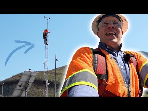
During a field presentation at Big Mountain Pass, a Utah Department of Transportation staff member said the agency operates about 200 Road Weather Information System stations statewide to monitor wind, snow depth and road conditions and to help maintenance crews decide when to clear roads and post warnings.
The Road Weather Information System (RWIS) stations collect data that UDOT maintenance sheds use to plan clearing operations and drive messages to motorists via variable message signs, the UDOT staff member said. The staff member identified Big Mountain Pass, at the top of East Canyon, as a site with a camera and snow-depth sensors that UDOT uses to time plowing and road closures. The staff member also named Lamb's Canyon as a location that commonly experiences strong, downhill winds that can cause blowing snow and icing.
A visitor who climbed the tower at the site described the experience as “a bit frightening,” saying they were wearing a safety harness and were unsure how the instruments worked. The visitor’s remarks were made while staff demonstrated the equipment on the tower.
UDOT staff described seasonal maintenance cycles in spring and fall and said sensor networks are located to capture the windiest edges of mountain ranges or the snowiest spots for each maintenance station’s area. The staff member said animals have chewed through power and communications wiring on some sensor installations; UDOT uses deterrents such as putty on conduit and steel wool to reduce that damage.
The staff member said RWIS output supports several operational uses: informing maintenance crews at sheds, feeding camera views and snow-depth readings for planners, and providing data for variable message signs to inform drivers. The staff member said one road near the demonstration site is “typically closed” in winter and had just opened recently, and that the sensors help the agency plan when to clear it.
There were no votes or formal policy actions associated with the demonstration. The presentation was descriptive: staff explained RWIS capabilities, maintenance concerns and how the data are used to support safety and operational decisions on Utah roads.