Study recommends Moorhead trailhead, Twelfth Avenue route for Heartland Trail extension
Get AI-powered insights, summaries, and transcripts
Sign Up Free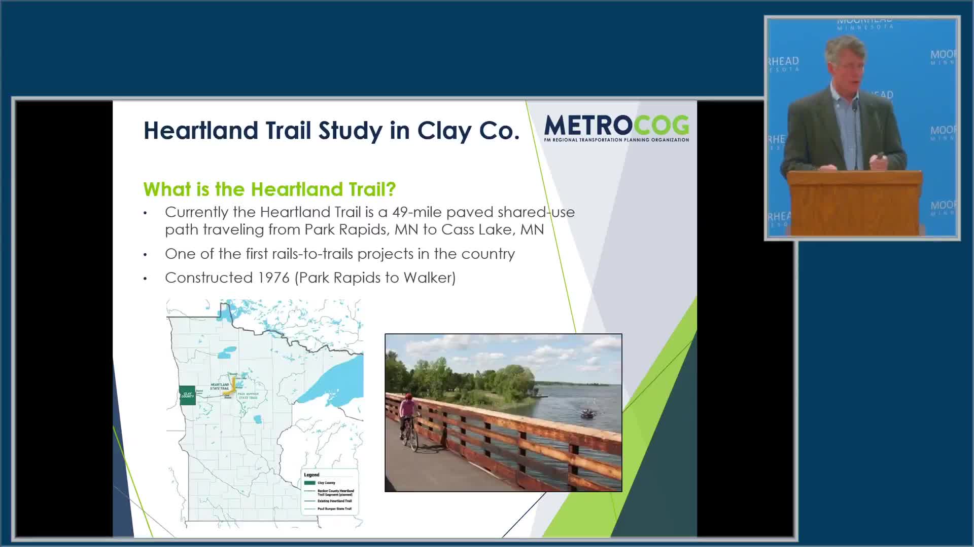
Summary
Consultants presented a draft Heartland Trail plan that favors a Moorhead trailhead at Centennial Park and an eastbound alignment along Twelfth Avenue toward Buffalo River State Park, while noting constraints from the Minnesota DNR master plan and funding and phasing needs.
Consultants for the Heartland Trail study told the Moorhead City Council on June 9 that their recommended alignment would start at Centennial Park in Moorhead and generally follow a Twelfth Avenue corridor east toward Buffalo River State Park.
The plan matters because the Heartland Trail is a state trail that trail planners hope to extend to the Fargo–Moorhead area; the draft study lays out routing, public engagement findings, costs and a multi-phase implementation approach.
Stuart Crosby, a landscape architect with SRF Consulting Group, said the recommended alignment “starts in Centennial Park on Fifteenth Avenue in Moorhead” and noted the trailhead could include parking, kiosks, bike racks and restrooms. Dan Farnsworth of the Metropolitan Council of Governments (Metro COG), who co-led the study, said the team emphasized staying within the Minnesota Department of Natural Resources (DNR) master plan corridor to avoid the lengthy process of a DNR master plan amendment.
The draft recommends a trail connection that uses Twelfth Avenue as a preferred east‑bound route out of Dilworth and direct connections to Moorhead’s existing trail system. Crosby said Twelfth Avenue was favored in public engagement because many respondents indicated they wanted access to Buffalo River State Park. The consultants divided the corridor across Clay County into phases and provided cost estimates and a suggested implementation sequence.
Consultants outlined public engagement and next steps. Farnsworth said the study began in January 2024, included two public open houses, landowner meetings and stakeholder sessions, and received hundreds of online contributions; the consultants recorded 354 contributions to an interactive map during the process. The team recommended forming a task force to determine lead entities (Metro COG, Clay County or a consortium of corridor communities), decide whether sections will be built as state or regional trail segments, pursue funding sources, and complete environmental review, right‑of‑way work and landowner discussions.
Crosby warned that routing outside the DNR master plan area would require a DNR master plan amendment, which would lengthen timelines. He also gave a planning‑level cost range for trail construction, telling the council “Trails cost anywhere between 750, thousand dollars to over a million dollars a mile to construct,” and recommended phasing work to match available funding and opportunities tied to local road projects.
Council members raised downtown access and transit connections. Council Member Deb White said she was “disappointed that there wasn't any mention of the idea of having the trailhead in Downtown Moorhead,” arguing a downtown trailhead would better support businesses and visitor activity. Farnsworth said the downtown option had been proposed late in the process and would need additional public vetting; he added that placing a state trailhead in downtown would likely require a DNR master plan amendment. Council Member Heather Niesmeyer noted interest in walkability, transit connections and continuing planning to link the trail into Moorhead’s downtown network.
The consultants said a finalized study will be presented to corridor jurisdictions and then to the Metro COG policy board, with an anticipated policy‑board approval in August. They emphasized that construction would be phased and contingent on securing funding and any necessary plan amendments.
The draft study and interactive materials remain available for review; consultants said they will finalize the document after the jurisdictional briefings and questions are resolved.