Get Full Government Meeting Transcripts, Videos, & Alerts Forever!
Get email alerts on the Land Use Growth Area topic
No spam. Unsubscribe anytime.
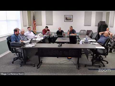
Powhatan subcommittee discusses expanding village growth area, flags creek boundary and walkability limits
Summary
At a Powhatan County Citizens Work Group housing and land-use subcommittee meeting, members debated whether to expand the county's village growth area shown on the 2021 future land-use map to include a roughly 200-to-380-acre band of undeveloped parcels south of the primary creek and north of Route 13.
At a Powhatan County Citizens Work Group housing and land-use subcommittee meeting, members debated whether to expand the county's village growth area shown on the 2021 future land-use map to include a roughly 200-to-380-acre band of undeveloped parcels south of the primary creek and north of Route 13.
The discussion centered on whether the board's village designation should be extended to encompass larger parcels west and south of the existing village core, balancing utility availability, environmental constraints and the stated goal of encouraging mixed-use, walkable development.
Why it matters: expanding a village growth area changes where higher-density, mixed-use development is considered appropriate on the future land-use map. That designation shapes later rezoning, utilities planning and developer proposals that affect traffic, conservation land and future housing types.
Subcommittee members and staff described three planning constraints that drove the debate. First, utility and service-district boundaries influence where sewer and water can practically serve higher-density projects; a service district yellow line on the map roughly follows current utility limits. Second, a green "prime conservation" overlay follows creeks, wetlands and floodplain and does not map to parcel lines; speakers said applicants historically respected that creek as a development cutoff. Third, walkability from the courthouse was repeatedly used as a planning metric: several members characterized a one-mile (about a 15-minute) walk from the courthouse as the functional radius for a village hub.
"If you put the bull's eye on the courthouse, and you were to go back up to Plainview, with a new east–west road that's just under it's just about a mile," said Don, a subcommittee member. "Adding that in there rounds out the designation for future planning purposes to have what would keep the hub at the courthouse walkable."
Members debated two alternative boundary approaches. One option would extend the village designation all the way to Route 60 (U.S. 60) and include frontage parcels that could accommodate commercial frontage. Several members opposed that because connecting directly to 60 could change the character of the village and encourage development oriented to the highway rather than a walkable core. An alternate approach favored by other members and by staff would use the creek as a northern boundary, keep commercial frontage near Route 60 on the north side of the green strip, and limit mixed-use, walkable development to parcels south of the creek and within roughly one mile of the courthouse.
"I want to keep it off of Route 60 so that this does not look like a high-density multifamily development around 60," said Chris, a subcommittee member. "The creek looks like a perfectly good boundary to compromise."
Participants also discussed parcel-level complications. Several parcels in the area already have split zoning or proffers that limit development past the creek; some narrow lots behind the commercial frontage are already built as lower-density residential with wells and septic. Speakers urged the group to avoid mapping changes that would bisect large parcels in a way that would make future development or road alignment awkward.
Staff noted prior rezonings in the area: some front parcels along Route 60 had been rezoned to commercial or commerce-center classifications while rear portions remained residential. "For the most part, the development through the rezoning process has stayed between 60 and the creek because it's a natural boundary," a staff member said.
The subcommittee discussed transportation implications and potential road connections to improve local circulation without routing traffic through the courthouse area. Several members said that creating a local, low-speed internal road network could support walkability while avoiding higher-speed connections to Route 60.
At the meeting's end a motion was made to adopt the board's exhibited map change that would place commercial frontage parcels on the north side of the green strip and to designate the land south of the creek as village/mixed-use (the motion text shown on the shared screen described splitting the parcel with commercial to the north and mixed use to the south). The motion was seconded and a voice vote was taken; the transcript records opposition to the motion but does not provide a formal tally. The subcommittee directed staff to refine parcel-level boundaries, use the creek as a recommended natural boundary where feasible, and return a revised map to the full working group for consideration.
"If you allow the especially high-density development, if you let that occur very close to 60, this becomes much more problematic," one member said. "If you say we're going to leave a little bit of a buffer here from 60, then you have something that might actually be politically feasible."
Next steps: staff will revise the proposed village boundary using the creek as a recommended northern limit for the mixed-use area, test a one-mile courthouse-centered walkability buffer for consistency, and prepare a parcel-level map for the full Citizens Work Group and the board. The subcommittee also asked staff to clarify service-district extents and to list parcels with existing proffers or split zoning as part of the next packet.
Ending note: members repeatedly emphasized that a future land-use designation is not a zoning change; parcel-level rezoning, proffers and environmental permitting would still be required before any development could proceed.