Get Full Government Meeting Transcripts, Videos, & Alerts Forever!
Get email alerts on the Land Use Airstrip topic
No spam. Unsubscribe anytime.
Mathews County hearing on Joseph Purdue’s request for grass airstrip draws neighbors’ safety, noise and wetlands concerns
Summary
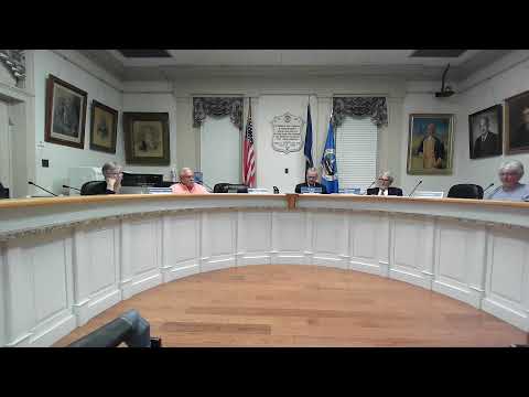
A May 20 joint meeting of Mathews County’s Planning Commission and Board of Supervisors focused on a conditional use permit sought by Joseph M. Purdue to move a grass airstrip closer to Route 14; the planning commission voted against it 4–3 and the board debated approving a revised permit with conditions.
Joseph M. Purdue asked Mathews County officials on May 20 to approve a conditional use permit to establish a grass airstrip on a 29‑acre parcel at the corner of State Route 14 and Picklefin Road, saying the field would serve his single‑engine short‑takeoff‑and‑landing (STOL) aircraft and occasional community events.
The request drew more than a dozen residents during the public hearing, who cited safety for motorists and children on Route 14, noise and potential impacts to nearby wetlands and property values. The county planning commission voted 4–3 against the permit; the county board of supervisors then began separate discussion and a roll‑call vote on a revised set of conditions, though the transcript does not contain the board’s final tally.
Why it matters: moving the grass airstrip closer to Route 14 would place takeoffs and landings nearer to a busy county road and established neighborhoods, prompting questions about enforcement of permit conditions, coordination with VDOT and Dominion Energy, and the strip’s long‑term status if the owner dies or sells the property.
Staff said the proposal (application 202401231) is for an aviation facility on Tax Map Parcel 20‑A‑9 in Rural (RU) zoning and described the site as about 29 acres. The application asks to discontinue an existing grass strip on a different parcel if the new CUP is approved. “This airplane is STOL capable,” staff told the boards, and noted that many aircraft of this kind can “take off with 200 feet of runway and land in 400 feet.” Staff also reported a wetlands delineation on part of the parcel and said three ditches across the western portion of the property would need to be piped if the strip is developed.
Residents who oppose the permit pointed to safety risks. Attorney Mark Lamb, representing neighbors, said small‑aircraft engine failures are most likely during takeoff and landing and warned that the proposed location is “closer proximity” to houses and to Route 14 than Purdue’s existing field. “Aircraft are noisy instruments,” Lamb said, and the change in location would be “a new potential risk of harm” to neighbors, he said.
Several neighbors asked for conditions that would strictly limit use: no night operations, no non‑emergency helicopters, limits on who may use the strip, restrictions on flights during school bus pickup and drop‑off hours, specific signage on Route 14, and an explicit requirement that the CUP become null and void if Purdue sells the property or dies. One resident noted a petition in the application packet with roughly 41 signatures opposing the proposal; other speakers said more than 60 neighbors had signed a petition.
Purdue said he has used the existing grass strip for about nine years without incidents and described limited use of his aircraft. “I use my airplane only a few days a month. Never at night, only during daylight hours,” Purdue said, and he said he typically flies about 18 times a year. He said the new strip is needed because the current landing area is being converted for wetland mitigation. He agreed during discussion to several conditions the boards proposed, including arranging signage and contact with Dominion Energy about adding visual markers on power lines.
Staff and outside agencies recommended conditions that would limit operations: no military helicopter operations; no takeoffs or landings during night as defined by the Federal Aviation Regulations (between evening civil twilight and morning civil twilight); takeoffs and landings limited to specified approaches so aircraft would cross Route 14 at or above a VDOT‑recommended glide slope (staff cited a 30‑foot clearance or roughly a 3‑degree approach); piping of three ditches on the property to make the western portion usable; and a requirement that the prior grass strip on parcel 28‑1 be discontinued if the new CUP is permitted. Commissioners also proposed additional restrictions, including a clause making the CUP void on the owner’s death or sale, and language limiting use to the applicant’s single‑engine light‑sport/STOL aircraft.
The planning commission advanced a motion that included staff analysis and 12 staff conditions plus added restrictions; that motion failed on a 4–3 vote. On the board floor, members debated similar conditions and asked the applicant to coordinate with VDOT and Dominion Energy for roadside signage and power‑line markers. Board members also discussed enforcement: county staff said they respond to complaints but acknowledged limits in code enforcement and staffing.
What’s next: the transcript records the start of a roll‑call vote by the Board of Supervisors on a motion to approve the CUP as amended (including conditions on signage, power‑line markers, limits on flights during school bus hours, a void‑on‑sale clause, and restrictions on night and helicopter operations); the transcript cuts off before the board’s final result is fully recorded. Board members discussed requiring the applicant to secure any VDOT approvals for signs in the highway right of way and to coordinate visual markers with Dominion Energy and VDOT before full implementation.
The record shows also that the state code (Code of Virginia, title 5.1, chapter 1) requires registration of private landing areas that are not within five miles of a commercial airport and that applicants and the county discussed FAA/VDOT guidance for approach clearance and safety. The board’s instructions and any final permit conditions will determine whether the proposed airstrip can proceed and under what enforceable limits.
Ending: County staff and several board members told residents they would expect the applicant to secure required approvals from VDOT and Dominion Energy and follow state and federal registration rules; neighbors said they would monitor conditions for enforcement requests. The board’s formal permit decision and any finalized written conditions will be posted in the county record after the meeting.