Get Full Government Meeting Transcripts, Videos, & Alerts Forever!
Get email alerts on the Flood Mitigation topic
No spam. Unsubscribe anytime.
Coconino County outlines post-wildfire flood response, long-term floodplain planning for Fort Valley
Summary
County and flood control officials presented post-wildfire flooding models for the Rio de Flag watershed, described short-term mitigation needs including sandbags and barriers, and said long-term floodplain engineering and funding work is starting but faces federal funding uncertainties.
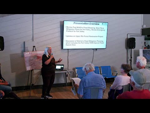
Coconino County officials on a community briefing in Fort Valley presented modeling of post-wildfire flood risk for the Rio de Flag watershed and described how they plan to stage emergency mitigation while launching a longer-term review of special flood hazard areas.
The county’s flood control director, Lucinda Andrean, said the county has used pre-fire and post-fire hydrologic modeling to show which neighborhoods are most likely to flood after a fire and what immediate measures would be needed. "Many of the homes will need to be completely surrounded by sandbags," Andrean said, and the county is planning staging and distribution that would allow crews to deploy supplies to neighborhoods quickly. She told the meeting the county’s planning estimates include "upwards of 800,000 sandbags" and that barriers will be needed for several miles, though the presentation did not specify an exact barrier length.
The modeling consultant, Joe Loveridge of J. E. Fuller, described the watershed analysis used to create relative-probability flood maps. Loveridge said the study modeled multiple burn footprints and short-duration, high-intensity monsoon storms to show where flooding is likely under different scenarios. "It's not a it's not a huge fire that that can make big, a big impact," he said, explaining that an Upper Rio watershed fire of about the size of previous regional fires could still produce serious downstream flooding. The maps identify orange zones where flooding is likely in most scenarios and fringe yellow zones that would require a larger storm or larger burn to flood.
County staff showed conceptual mitigation maps that mark areas for sandbagging and where sturdier barriers such as 42-inch concrete Jersey barriers would be needed. The county plans to field-fit installations during an event, using barriers where water depth and velocity would make sandbags insufficient, and to stage equipment and material near neighborhood access points. Chris Dusa, a county flood planner, and other staff are available to review parcel-level maps with residents after the briefing.
Supervising County Supervisor Patrice Horstman and county staff said the county is also moving beyond immediate response planning into a formal reassessment of FEMA special flood hazard areas and prioritized flood mitigation projects. Horstman warned that federal funding is uncertain: she said "there's a movement by this Administration to eliminate FEMA" and noted that a key grant program used previously for construction is gone. County presenters said a remaining federal option is the Flood Mitigation Assistance Program but emphasized that future grant success will require strong benefit-cost analyses and federal partnership.
Officials described the practical implications for homeowners: if a property is in a special flood hazard area and the owner has a mortgage, flood insurance may be required; the county intends to evaluate mitigation projects with economic impact and funding feasibility as primary criteria. The county also solicited local historical photos and resident reports to improve the flood-event record; staff will post materials and maps to the county website and hold future community meetings during the multi-year planning process.
The briefing closed with staff offering one-on-one review of flood maps and sandbag/barrier plans at tables outside the main room.
Residents seeking parcel-specific flood-mitigation information were directed to county staff at the event and to the county flood-control webpages for maps and model data.