Get Full Government Meeting Transcripts, Videos, & Alerts Forever!
Get email alerts on the Weather Forecast topic
No spam. Unsubscribe anytime.
National Weather Service: above‑normal 2025 Atlantic season likely; water hazards top risk for Florida coast
Summary
The National Weather Service office in Melbourne told Port Canaveral partners that Colorado State and the National Hurricane Center forecast an above‑normal 2025 season, emphasized storm surge and freshwater flooding risks, and advised preparations ahead of an August–October peak.
The National Weather Service office in Melbourne told Port Canaveral stakeholders the 2025 Atlantic hurricane season is likely to be busier than average and urged readiness for multiple hazards beyond wind.
Will Ulrich, warning coordination meteorologist for the National Weather Service in Melbourne, summarized why tropical cyclones matter to the port community and said forecasting improvements focus on track and timing but uncertainty remains for intensity: “tropical cyclones or hurricanes, tropical storms come in all shapes and sizes, And they bring with them more than just the wind threat.”
Ulrich emphasized three key points for operators: storm surge is the greatest single threat to life and property in coastal landfalls; freshwater flooding is the most common killer in tropical cyclones; and tornadoes can produce concentrated, severe damage well away from a storm’s center. He noted that rapid intensification is important for planning because several historically destructive landfalls were tropical storms only two days before landfall.
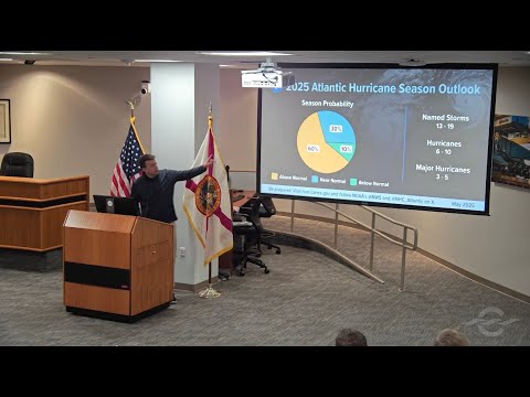
National centers and academic forecasts cited at the meeting (Colorado State University and the National Hurricane Center) both indicated an above‑normal season. Ulrich said the National Hurricane Center issues watches and warnings about 48–60 hours before expected conditions; earlier products such as 7‑day tropical weather outlooks and wind‑speed‑probability graphics can inform decisions made farther in advance.
Ulrich urged local stakeholders to prepare by June 1 and be fully ready by August 1, the period when about 85 percent of Atlantic activity historically occurs. He also discussed forecast graphics and common misinterpretations of the NHC track cone: the cone shows only the expected path of the storm’s center, not the full area of impact, and the office is experimenting with graphics that overlay watches and warnings to reduce focus on the cone. He added that rip currents and post‑storm heat risk are relevant hazards for East Central Florida even when the main storm center tracks elsewhere.
Ulrich closed with a seasonal outlook summary and the 2025 name list shown during the meeting; he encouraged operators to rely on weather.gov/mlb and official NWS/NHC products for decisions.